Area Overview for B5 7XP
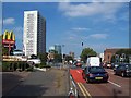
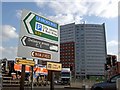
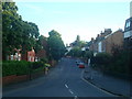
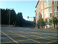
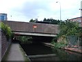
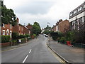
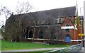
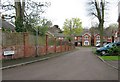
Photos of B5 7XP
Area Information
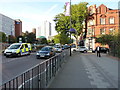
Living in B5 7XP means residing in a small residential cluster covering just 9,727 square metres in the south of Birmingham. This specific postcode sits within the Balsall Heath West ward, an urban area created in 2018 following boundary changes that expanded Birmingham's wards to 69. The entire ward holds a population of approximately 11,165, giving this tiny enclave a dense and purposeful character. Residents experience daily life within a community that has evolved from historic farmland to modern urban living. The area was annexed into Birmingham on 1 October 1891, bringing new infrastructure like the library and baths that still define the neighbourhood's cultural footprint. While the broader ward saw significant decline during the 1970s and 1980s, recent initiatives have reshaped the local environment. Today, the residential cluster offers a compact living experience where proximity to both city centre developments like Centenary Square and local heritage sites interacts closely. You are part of a functional urban node that balances its Victorian history with contemporary housing needs.
- Area Type
- Postcode
- Area Size
- 9727 m²
- Population
- 2431
- Population Density
- 10197 people/km²
The property market in B5 7XP is defined by its high density and low ownership rates. With home ownership sitting at just 15 per cent, the area functions primarily as a rental market rather than a traditional owner-occupied neighbourhood. The predominant accommodation type is flats, which aligns with the small physical footprint of 9,727 square metres. This housing stock caters to smaller households and individuals who prioritise convenience over property equity. Buyers looking at this specific postcode should expect a competitive letting environment where demand is high relative to the limited supply of dwellings. The concentration of flats suggests a layout designed for vertical living, offering proximity to amenities without the space of detached homes. This makes the area attractive to young professionals and students, matching the median age of 22 years found in the local population. If you are considering purchasing, the low ownership percentage indicates that fresh buyers will face significant rivalry from existing tenants or intermediaries dealing in rental conversions.
House Prices in B5 7XP
Showing 24 properties
| Address | Type | Beds | Baths | Last Sale Price | Last Sale Date | |
|---|---|---|---|---|---|---|
| Flat 6, 46 Benmore Avenue, Birmingham, B5 7XP | Maisonette | - | - | - | - | |
| Flat 7, 46 Benmore Avenue, Birmingham, B5 7XP | Maisonette | - | - | - | - | |
| Flat 1, 42 Benmore Avenue, Birmingham, B5 7XP | Maisonette | - | - | - | - | |
| Flat 1, 46 Benmore Avenue, Birmingham, B5 7XP | Maisonette | - | - | - | - | |
| Flat 2, 46 Benmore Avenue, Birmingham, B5 7XP | Maisonette | - | - | - | - | |
| Flat 7, 44 Benmore Avenue, Birmingham, B5 7XP | Flat | - | - | - | - | |
| Flat 5, 42 Benmore Avenue, Birmingham, B5 7XP | Maisonette | - | - | - | - | |
| Flat 1, 44 Benmore Avenue, Birmingham, B5 7XP | Maisonette | - | - | - | - | |
| Flat 5, 46 Benmore Avenue, Birmingham, B5 7XP | Maisonette | - | - | - | - | |
| Flat 5, 44 Benmore Avenue, Birmingham, B5 7XP | Maisonette | - | - | - | - |
Energy Efficiency in B5 7XP
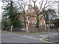
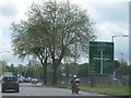
Daily life in B5 7XP is supported by immediate access to essential amenities and retail outlets. Residents can easily reach Co-op Birmingham, Morrisons Daily, and Co-op Edgbaston for weekly shopping and groceries. For those requiring quicker trips, the presence of five nearby retail outlets ensures convenience. Transport connectivity extends beyond shopping; five railway stations and five metro stops within reach provide swift access to the wider city. You can step out to reach Five Ways Railway Station, Birmingham Moor Street Railway Station, or Bordesley Railway Station depending on your destination. Cultural and community life thrives thanks to nearby landmarks like Calthorpe Park, which opened in 1857, and Balsall Heath Park, established in 1894. These green spaces offer expansive areas for recreation and relaxation close to home. Historical sites add depth to the area, including the Balsall Heath Library opened in 1895 and the Balsall Heath Baths which opened in 1907. For leisure, early cinemas such as the Triangle on Gooch Street and The Imperial on Moseley Road once defined the entertainment scene, leaving a legacy of diverse cultural engagement. Religious facilities, including a Shia Mosque opened on Clifton Road in 1982, also contribute to the local community landscape.
Amenities
Schools
Families considering homes in B5 7XP have access to several educational institutions within practical reach. The area is served by Lillian De Lissa Nursery School, providing early years education for pre-school children. Primary education is primarily delivered through Lee Bank Junior and Infant School and Woodview Primary School, which offer foundational learning for young students. For secondary education, Oasis Academy Woodview operates as a local academy. This school holds a 'good' Ofsted rating, a critical benchmark for parents evaluating quality and standards. The presence of these specific schools ensures that residents have multiple pathways for their children's development from nursery age through to secondary levels. The mix of nursery, primary, and academy provision supports the high youth population and the low median age found in the ward. While specific Ofsted ratings are only provided for the academy, the choice of multiple primary options gives families flexibility in selecting an educational environment that suits their preferences.
| Rank | School | Type | Entry gender | Ages |
|---|
Explore more schools in this area
Go to Schools tabDemographics
The community in B5 7XP reflects a young demographic profile typical of many UK cities. The median age stands at 22 years, indicating a population skewed heavily towards youth. Despite this low median age, adults between 30 and 64 years remain the most common age range within the wider area, suggesting a mix of young professionals and established residents. Home ownership stands at just 15 per cent, which is significantly lower than the national average and points to a market dominated by renters. This statistic confirms that the majority of households operate as rentals rather than owner-occupied homes. Accommodation types are predominantly flats, fitting the high-density nature of the 9,727 square metre cluster. The area is also home to one of the largest Muslim communities in Birmingham, with the community established there from June 1940. This diversity fosters a dynamic social fabric where varied cultural influences shape local life. The low home ownership rate implies that stability often relies on long-term tenancy agreements rather than mortgage portfolios.
Household Size
Accommodation Type
Tenure
Ethnic Group
Religion
Household Composition
Age
Household Deprivation
NS-SEC
Explore more demographic insights in this area
Go to Demographics tabPlanning
Planning Constraints
- Flood RiskPremium
- Ramsar Wetland SitesPremium
- Area of Outstanding Natural BeautyPremium
- Protected Nature ReservePremium
- Protected WoodlandPremium