Area Overview for B5 7XH
Photos of B5 7XH
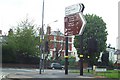
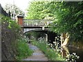
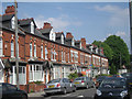
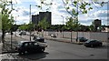


100 photos from this area
Area Information
Key information about the B5 7XH including its size, population, and administrative classification.
- Area Type
- Postcode
- Area Size
- 1.9 hectares
- Population
- 1705
- Population Density
- 6634 people/km²
House Prices in B5 7XH
57
Properties
£932,727
Average Sold Price
£94,000
Lowest Price
£8,300,000
Highest Price
Showing 57 properties
| Address | Type | Beds | Baths | Last Sale Price | Last Sale Date | |
|---|---|---|---|---|---|---|
| 132 Bristol Road, Edgbaston, Birmingham, B5 7XH | Terraced | 3 | 2 | £260,000 | May 2025 | |
| 162 Bristol Road, Edgbaston, Birmingham, B5 7XH | Detached | 4 | 2 | £575,000 | Mar 2025 | |
| 112 Bristol Road, Edgbaston, Birmingham, B5 7XH | Terraced | 3 | 1 | £255,000 | Apr 2024 | |
| 140 Bristol Road, Edgbaston, Birmingham, B5 7XH | Semi-detached | 4 | 2 | £557,500 | Jun 2021 | |
| 138 Bristol Road, Edgbaston, Birmingham, B5 7XH | Semi-detached | 4 | 3 | £620,000 | Aug 2020 | |
| 160 Bristol Road, Edgbaston, Birmingham, B5 7XH | Detached | 7 | 2 | £545,000 | Apr 2018 | |
| 108 Bristol Road, Edgbaston, Birmingham, B5 7XH | Terraced | 3 | 1 | £175,000 | Jan 2017 | |
| 156 Bristol Road, Edgbaston, Birmingham, B5 7XH | Semi-detached | - | - | £8,300,000 | Aug 2015 | |
| 122 Bristol Road, Edgbaston, Birmingham, B5 7XH | Terraced | 3 | 2 | £94,000 | Jul 2014 | |
| 120 Bristol Road, Edgbaston, Birmingham, B5 7XH | Detached | 3 | 2 | £119,000 | Jul 2008 |
Page 1 of 6
Energy Efficiency in B5 7XH
Amenities
Schools
| Rank | School | Type | Entry gender | Ages |
|---|
Explore more schools in this area
Go to Schools tabDemographics
Household Size
One person
most common
Accommodation Type
Flats
most common
Tenure
20
majority
Ethnic Group
White
most common
Religion
N/A
most common
Household Composition
N/A
most common
Age
47
median
Adults (30-64 years)
most common
Household Deprivation
N/A
with no deprivation
NS-SEC
23
in Lower managerial occupations
Explore more demographic insights in this area
Go to Demographics tabPlanning
Planning Constraints
- Flood RiskPremium
- Ramsar Wetland SitesPremium
- Area of Outstanding Natural BeautyPremium
- Protected Nature ReservePremium
- Protected WoodlandPremium