Area Overview for B49 5AB
Photos of B49 5AB
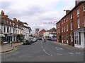
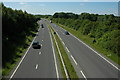
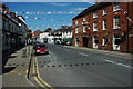

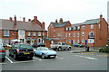
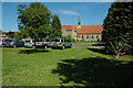
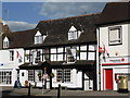
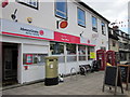
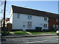
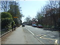
89 photos from this area
Area Information
Key information about the B49 5AB including its size, population, and administrative classification.
- Area Type
- Postcode
- Area Size
- 4341 m²
- Population
- 1578
- Population Density
- 116 people/km²
House Prices in B49 5AB
14
Properties
£176,817
Average Sold Price
£32,500
Lowest Price
£399,950
Highest Price
Showing 14 properties
| Address | Type | Beds | Baths | Last Sale Price | Last Sale Date | |
|---|---|---|---|---|---|---|
| 34A High Street, Alcester, B49 5AB | house | - | - | £98,000 | Jan 2024 | |
| 28 High Street, Alcester, B49 5AB | Detached | 4 | 2 | £399,950 | Nov 2020 | |
| 22 High Street, Alcester, B49 5AB | Retail | - | - | £32,500 | Sep 1995 | |
| The Stone House, 42 High Street, Alcester, B49 5AB | Detached | 3 | 1 | - | - | |
| Flat, 32A High Street, Alcester, B49 5AB | Flat | - | - | - | - | |
| Flat, 34B High Street, Alcester, B49 5AB | Flat | - | - | - | - | |
| 30B High Street, Alcester, B49 5AB | Flat | - | - | - | - | |
| 32A High Street, Alcester, B49 5AB | Maisonette | - | - | - | - | |
| 30A High Street, Alcester, B49 5AB | Flat | 3 | 1 | - | - | |
| 50 High Street, Alcester, B49 5AB | Flat | - | - | - | - |
Page 1 of 2
Energy Efficiency in B49 5AB
Amenities
Schools
| Rank | School | Type | Entry gender | Ages |
|---|
Explore more schools in this area
Go to Schools tabDemographics
Household Size
Two person
most common
Accommodation Type
Houses
most common
Tenure
67
majority
Ethnic Group
White
most common
Religion
N/A
most common
Household Composition
N/A
most common
Age
47
median
Adults (30-64 years)
most common
Household Deprivation
N/A
with no deprivation
NS-SEC
40
in Lower managerial occupations
Explore more demographic insights in this area
Go to Demographics tabPlanning
Planning Constraints
- Flood RiskPremium
- Ramsar Wetland SitesPremium
- Area of Outstanding Natural BeautyPremium
- Protected Nature ReservePremium
- Protected WoodlandPremium