Area Overview for B48 7SQ
Photos of B48 7SQ
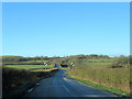
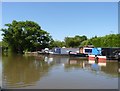
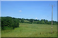
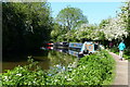
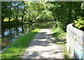
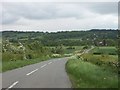
26 photos from this area
Area Information
Key information about the B48 7SQ including its size, population, and administrative classification.
- Area Type
- Postcode
- Area Size
- 30.5 hectares
- Population
- 1570
- Population Density
- 980 people/km²
House Prices in B48 7SQ
8
Properties
£595,000
Average Sold Price
£375,000
Lowest Price
£815,000
Highest Price
Showing 8 properties
| Address | Type | Beds | Baths | Last Sale Price | Last Sale Date | |
|---|---|---|---|---|---|---|
| Scarfield Farm Bungalow, Scarfield Hill, Alvechurch, B48 7SQ | Bungalow | - | - | £815,000 | Jun 2016 | |
| Scarfield Barn, Scarfield Hill, Alvechurch, B48 7SQ | Semi-detached | 3 | 2 | £375,000 | Jun 2014 | |
| Narrow Boat Rosie, Orchard Moorings, Station Road, Alvechurch, B48 7SQ | Houseboat | - | - | - | - | |
| Scarfield Farm, Scarfield Hill, Alvechurch, B48 7SQ | Semi-detached | - | - | - | - | |
| Scarfield Farm House, Scarfield Hill, Alvechurch, B48 7SQ | Detached | - | - | - | - | |
| The Weighbridge, Scarfield Hill, Alvechurch, B48 7SQ | pub | - | - | - | - | |
| Alvechurch Dog Grooming And Dog Park, Scarfield Hill, Alvechurch, B48 7SQ | commercial | - | - | - | - | |
| Mv Like Ducks To Water, Scarfield Wharf, Scarfield Hill, Alvechurch, B48 7SQ | Houseboat | - | - | - | - |
Energy Efficiency in B48 7SQ
Amenities
Schools
| Rank | School | Type | Entry gender | Ages |
|---|
Explore more schools in this area
Go to Schools tabDemographics
Household Size
Two person
most common
Accommodation Type
Houses
most common
Tenure
67
majority
Ethnic Group
White
most common
Religion
N/A
most common
Household Composition
N/A
most common
Age
47
median
Adults (30-64 years)
most common
Household Deprivation
N/A
with no deprivation
NS-SEC
40
in Lower managerial occupations
Explore more demographic insights in this area
Go to Demographics tabPlanning
Planning Constraints
- Flood RiskPremium
- Ramsar Wetland SitesPremium
- Area of Outstanding Natural BeautyPremium
- Protected Nature ReservePremium
- Protected WoodlandPremium