Area Overview for B48 7SE
Photos of B48 7SE

Area Information
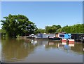
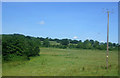
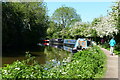
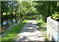
Alvechurch is a historic civil parish and village situated in the Bromsgrove District, which falls within the West Midlands region of England. This area, identified by the postcode B48 7SE, covers a small residential cluster of just 13.4 hectares. The community is defined by its long-standing history, having been featured in the Domesday Book of 1086 and later serving as the site of a royal palace and annual fair under the Bishop of Worcester. Today, a population of 1,484 residents live in this compact space, creating a village feel despite the area's proximity to larger towns. The distinction of B48 7SE lies in its preservation of heritage, featuring the Church of St Laurence and medieval buildings alongside 19th-century gardens designed by William Butterfield. You will find yourself in a location where the quiet rhythm of village life coexists with practical access to urban centres. The area operates as a tight-knit cluster, offering a specific environment for those seeking a historically rich yet manageable domestic setting in Worcestershire. Behind the {area} name lies a place where history shapes the present, from the parish plan to the national needle museum nearby.
- Area Type
- Postcode
- Area Size
- 13.4 hectares
- Population
- 1484
- Population Density
- 1185 people/km²
The housing stock in {area} is defined by a high degree of permanence. With 87% home ownership, the majority of {homes in {area}} are owned outright or with a mortgage, creating a market distinct from areas dominated by private landlords. This statistic means that when buying {homes in {area}}, you will largely encounter private sales rather than rental-first environments. The predominant accommodation type is Houses, which spans the village's various historical periods from medieval to Victorian. You will find a range of property styles, including the former schoolmaster's house and church-associated dwellings that dot the landscape. This high ownership rate signals a stable property market where estates are often held long-term. For buyers, this suggests a community where properties are not frequently flipped, adding a layer of continuity to the village character. The nature of accommodation in {area} supports families and individuals seeking stability in a small residential cluster. Understanding that 14 out of every 100 households own their homes helps you gauge the type of neighbours and the nature of the local estate agents you might encounter.
House Prices in B48 7SE
Showing 13 properties
| Address | Type | Beds | Baths | Last Sale Price | Last Sale Date | |
|---|---|---|---|---|---|---|
| Station House, Station Road, Alvechurch, B48 7SE | Detached | 3 | 1 | £235,000 | Apr 2015 | |
| Alvechurch Station, Alvechurch Railway Station, Station Road, Alvechurch, B48 7SE | commercial | - | - | - | - | |
| 9, Lewkner Cottages, Station Road, Alvechurch, B48 7SE | Bungalow | - | - | - | - | |
| 2, Lewkner Cottages, Station Road, Alvechurch, B48 7SE | Bungalow | - | - | - | - | |
| 10, Lewkner Cottages, Station Road, Alvechurch, B48 7SE | Bungalow | - | - | - | - | |
| 1, Lewkner Cottages, Station Road, Alvechurch, B48 7SE | Bungalow | - | - | - | - | |
| 5, Lewkner Cottages, Station Road, Alvechurch, B48 7SE | Flat | - | - | - | - | |
| 3, Lewkner Cottages, Station Road, Alvechurch, B48 7SE | Flat | - | - | - | - | |
| 7, Lewkner Cottages, Station Road, Alvechurch, B48 7SE | Bungalow | - | - | - | - | |
| 8, Lewkner Cottages, Station Road, Alvechurch, B48 7SE | Bungalow | - | - | - | - |
Energy Efficiency in B48 7SE
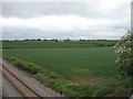
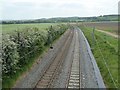
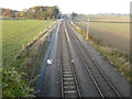
Living in {area} offers easy access to essential amenities without requiring a long commute for your daily needs. Five railway stations fall within practical reach, including Alvechurch Railway Station, Barnt Green Railway Station, and Redditch Railway Station. This rail network connects {area} to major hubs like Birmingham and Lichfield via the Cross-City Line. For shopping, you have access to five convenient retail options, such as the Co-op in Alvechurch, the Waitrose branch, and the Tesco in Barnt Green. These amenities are近在咫尺, meaning you can handle your grocery and weekly shopping requirements without extensive travel. The village itself features the Alvechurch Parish Council building and local shops, ensuring you do not need to venture far for daily necessities. Whether you are grabbing lunch or stocking up on goods, the combination of nearby high streets and local village facilities provides comprehensive convenience. This layout means you maintain village charm while retaining the accessibility of a small town's commercial infrastructure.
Amenities
Schools
| Rank | School | Type | Entry gender | Ages |
|---|
Explore more schools in this area
Go to Schools tabDemographics
The residents of {area} reflect a stable, long-term community with a median age of 47 years. The most common age range consists of adults between 30 and 64, suggesting a population dominated by families and established households rather than students or retirees. Home ownership stands at 87%, indicating that {homes in {area}} are largely settled properties passed down through generations or purchased with long-term intent rather than short-term rentals. This high rate of ownership aligns with the predominance of Houses as the primary accommodation type, reinforcing the residential character of the postcode. The population is overwhelmingly White, and the demographic profile suggests a neighbourhood without significant shifts in recent years. You can expect a community where neighbours often know one another well, supported by the fact that 87% of properties are owner-occupied. This stability creates a predictable environment for your daily life, where the majority of residents have deep roots in the village. The balance of age and ownership allows for a calm domestic atmosphere where families can settle down away from the fluctuations of transient housing markets.
Household Size
Accommodation Type
Tenure
Ethnic Group
Religion
Household Composition
Age
Household Deprivation
NS-SEC
Explore more demographic insights in this area
Go to Demographics tabPlanning
Planning Constraints
- Flood RiskPremium
- Ramsar Wetland SitesPremium
- Area of Outstanding Natural BeautyPremium
- Protected Nature ReservePremium
- Protected WoodlandPremium