Area Overview for B46 1SD
Photos of B46 1SD
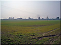

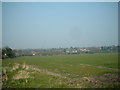
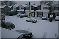
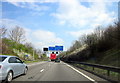
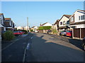
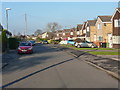
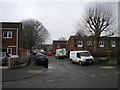
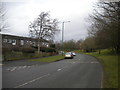
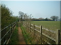


19 photos from this area
Area Information
Key information about the B46 1SD including its size, population, and administrative classification.
- Area Type
- Postcode
- Area Size
- 27.0 hectares
- Population
- 1634
- Population Density
- 1428 people/km²
House Prices in B46 1SD
11
Properties
£325,143
Average Sold Price
£130,000
Lowest Price
£525,000
Highest Price
Showing 11 properties
| Address | Type | Beds | Baths | Last Sale Price | Last Sale Date | |
|---|---|---|---|---|---|---|
| 64 Attleboro Lane, Water Orton, B46 1SD | Detached | - | - | £340,000 | Sep 2018 | |
| 62 Attleboro Lane, Water Orton, B46 1SD | Detached | 3 | 1 | £350,000 | Jun 2017 | |
| 68 Attleboro Lane, Water Orton, B46 1SD | Detached | 4 | - | £306,000 | May 2017 | |
| 76 Attleboro Lane, Water Orton, B46 1SD | Semi-detached | 3 | - | £270,000 | Jul 2014 | |
| Attleborough Farm, Attleboro Lane, Water Orton, B46 1SD | Semi-detached | - | - | £525,000 | Jan 2007 | |
| Oak Barn, Attleboro Lane, Water Orton, B46 1SD | Semi-detached | 4 | 4 | £355,000 | Jul 2003 | |
| 70 Attleboro Lane, Water Orton, B46 1SD | Detached | 3 | 1 | £130,000 | Sep 2000 | |
| 66 Attleboro Lane, Water Orton, B46 1SD | Semi-detached | 4 | 4 | - | - | |
| 72 Attleboro Lane, Water Orton, B46 1SD | barn | 4 | 4 | - | - | |
| 74 Attleboro Lane, Water Orton, B46 1SD | Semi-detached | - | - | - | - |
Page 1 of 2
Energy Efficiency in B46 1SD
Amenities
Schools
| Rank | School | Type | Entry gender | Ages |
|---|
Explore more schools in this area
Go to Schools tabDemographics
Household Size
Two person
most common
Accommodation Type
Houses
most common
Tenure
80
majority
Ethnic Group
White
most common
Religion
N/A
most common
Household Composition
N/A
most common
Age
47
median
Adults (30-64 years)
most common
Household Deprivation
N/A
with no deprivation
NS-SEC
36
in Lower managerial occupations
Explore more demographic insights in this area
Go to Demographics tabPlanning
Planning Constraints
- Flood RiskPremium
- Ramsar Wetland SitesPremium
- Area of Outstanding Natural BeautyPremium
- Protected Nature ReservePremium
- Protected WoodlandPremium