Area Overview for B44 8SG
Photos of B44 8SG
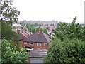
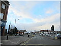
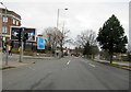


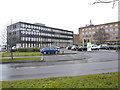
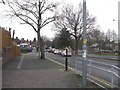
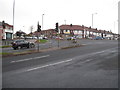
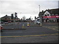
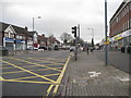

24 photos from this area
Area Information
Key information about the B44 8SG including its size, population, and administrative classification.
- Area Type
- Postcode
- Area Size
- 8733 m²
- Population
- 1590
- Population Density
- 6404 people/km²
House Prices in B44 8SG
26
Properties
£116,922
Average Sold Price
£50,000
Lowest Price
£183,600
Highest Price
Showing 26 properties
| Address | Type | Beds | Baths | Last Sale Price | Last Sale Date | |
|---|---|---|---|---|---|---|
| 29 Dyas Road, Birmingham, B44 8SG | house | - | - | £183,600 | Jun 2021 | |
| 57 Dyas Road, Birmingham, B44 8SG | Semi-detached | 3 | 2 | £162,000 | May 2021 | |
| 51 Dyas Road, Birmingham, B44 8SG | Semi-detached | 3 | 1 | £166,500 | Nov 2020 | |
| 59 Dyas Road, Birmingham, B44 8SG | house | - | - | £130,000 | Sep 2017 | |
| 39 Dyas Road, Birmingham, B44 8SG | house | - | - | £146,000 | Jun 2017 | |
| 21 Dyas Road, Birmingham, B44 8SG | Semi-detached | 3 | 1 | £146,000 | May 2017 | |
| 35 Dyas Road, Birmingham, B44 8SG | house | - | - | £115,000 | Feb 2016 | |
| 67 Dyas Road, Birmingham, B44 8SG | house | - | - | £129,500 | Apr 2014 | |
| 33 Dyas Road, Birmingham, B44 8SG | house | - | - | £126,200 | Dec 2009 | |
| 69 Dyas Road, Birmingham, B44 8SG | Semi-detached | 5 | - | £145,000 | Feb 2008 |
Page 1 of 3
Energy Efficiency in B44 8SG
Amenities
Schools
| Rank | School | Type | Entry gender | Ages |
|---|
Explore more schools in this area
Go to Schools tabDemographics
Household Size
Family (3-5 people)
most common
Accommodation Type
Houses
most common
Tenure
78
majority
Ethnic Group
White
most common
Religion
N/A
most common
Household Composition
N/A
most common
Age
47
median
Adults (30-64 years)
most common
Household Deprivation
N/A
with no deprivation
NS-SEC
24
in Lower managerial occupations
Explore more demographic insights in this area
Go to Demographics tabPlanning
Planning Constraints
- Flood RiskPremium
- Ramsar Wetland SitesPremium
- Area of Outstanding Natural BeautyPremium
- Protected Nature ReservePremium
- Protected WoodlandPremium