Area Overview for B44 8SE
Photos of B44 8SE
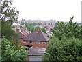
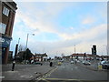
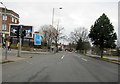


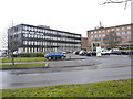
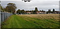
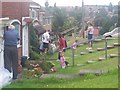
24 photos from this area
Area Information
Key information about the B44 8SE including its size, population, and administrative classification.
- Area Type
- Postcode
- Area Size
- 1.6 hectares
- Population
- 1590
- Population Density
- 6404 people/km²
House Prices in B44 8SE
46
Properties
£120,933
Average Sold Price
£34,000
Lowest Price
£215,000
Highest Price
Showing 46 properties
| Address | Type | Beds | Baths | Last Sale Price | Last Sale Date | |
|---|---|---|---|---|---|---|
| 38 Dyas Road, Birmingham, B44 8SE | Semi-detached | 3 | 1 | £181,000 | Apr 2024 | |
| 78 Dyas Road, Birmingham, B44 8SE | Semi-detached | 3 | 1 | £200,000 | Dec 2023 | |
| 98 Dyas Road, Birmingham, B44 8SE | Semi-detached | 3 | 1 | £197,000 | Sep 2023 | |
| 50 Dyas Road, Birmingham, B44 8SE | Semi-detached | 3 | 1 | £202,000 | Jul 2023 | |
| 84 Dyas Road, Birmingham, B44 8SE | house | - | - | £195,575 | Nov 2022 | |
| 70 Dyas Road, Birmingham, B44 8SE | house | 3 | - | £205,000 | Sep 2022 | |
| 86 Dyas Road, Birmingham, B44 8SE | house | - | - | £215,000 | Jan 2022 | |
| 44 Dyas Road, Birmingham, B44 8SE | house | - | - | £182,000 | Nov 2021 | |
| 40 Dyas Road, Birmingham, B44 8SE | house | - | - | £90,000 | May 2020 | |
| 56 Dyas Road, Birmingham, B44 8SE | Semi-detached | 3 | 1 | £157,000 | Oct 2018 |
Page 1 of 5
Energy Efficiency in B44 8SE
Amenities
Schools
| Rank | School | Type | Entry gender | Ages |
|---|
Explore more schools in this area
Go to Schools tabDemographics
Household Size
Family (3-5 people)
most common
Accommodation Type
Houses
most common
Tenure
78
majority
Ethnic Group
White
most common
Religion
N/A
most common
Household Composition
N/A
most common
Age
47
median
Adults (30-64 years)
most common
Household Deprivation
N/A
with no deprivation
NS-SEC
24
in Lower managerial occupations
Explore more demographic insights in this area
Go to Demographics tabPlanning
Planning Constraints
- Flood RiskPremium
- Ramsar Wetland SitesPremium
- Area of Outstanding Natural BeautyPremium
- Protected Nature ReservePremium
- Protected WoodlandPremium