Area Overview for B44 8JU
Photos of B44 8JU
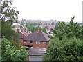
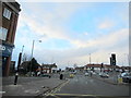
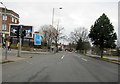


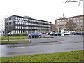
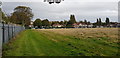

24 photos from this area
Area Information
Key information about the B44 8JU including its size, population, and administrative classification.
- Area Type
- Postcode
- Area Size
- 2.3 hectares
- Population
- 1654
- Population Density
- 5100 people/km²
House Prices in B44 8JU
30
Properties
£140,000
Average Sold Price
£43,000
Lowest Price
£236,000
Highest Price
Showing 30 properties
| Address | Type | Beds | Baths | Last Sale Price | Last Sale Date | |
|---|---|---|---|---|---|---|
| 111 Kingstanding Road, Birmingham, B44 8JU | house | 3 | - | £235,000 | Sep 2021 | |
| 109 Kingstanding Road, Birmingham, B44 8JU | Semi-detached | 3 | 2 | £210,000 | Jul 2020 | |
| 129 Kingstanding Road, Birmingham, B44 8JU | Semi-detached | 3 | 2 | £236,000 | Nov 2019 | |
| 127 Kingstanding Road, Birmingham, B44 8JU | Semi-detached | 3 | 1 | £200,000 | Jan 2018 | |
| 131 Kingstanding Road, Birmingham, B44 8JU | house | - | - | £135,000 | Dec 2013 | |
| 117 Kingstanding Road, Birmingham, B44 8JU | Semi-detached | 3 | 1 | £127,000 | Aug 2006 | |
| 139 Kingstanding Road, Birmingham, B44 8JU | Terraced | - | - | £153,000 | Apr 2005 | |
| 115 Kingstanding Road, Birmingham, B44 8JU | Semi-detached | - | - | £73,000 | Dec 2000 | |
| 119 Kingstanding Road, Birmingham, B44 8JU | Terraced | - | - | £57,000 | Jul 1999 | |
| 135 Kingstanding Road, Birmingham, B44 8JU | Semi-detached | - | - | £71,000 | May 1999 |
Page 1 of 3
Energy Efficiency in B44 8JU
Amenities
Schools
| Rank | School | Type | Entry gender | Ages |
|---|
Explore more schools in this area
Go to Schools tabDemographics
Household Size
Two person
most common
Accommodation Type
Houses
most common
Tenure
66
majority
Ethnic Group
White
most common
Religion
N/A
most common
Household Composition
N/A
most common
Age
47
median
Adults (30-64 years)
most common
Household Deprivation
N/A
with no deprivation
NS-SEC
20
in Lower managerial occupations
Explore more demographic insights in this area
Go to Demographics tabPlanning
Planning Constraints
- Flood RiskPremium
- Ramsar Wetland SitesPremium
- Area of Outstanding Natural BeautyPremium
- Protected Nature ReservePremium
- Protected WoodlandPremium