Area Overview for B44 8JS
Photos of B44 8JS
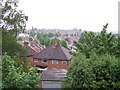
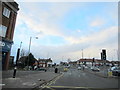
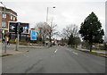


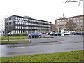
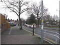
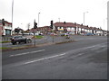
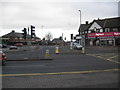
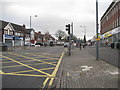
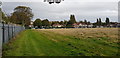
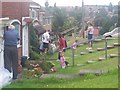
24 photos from this area
Area Information
Key information about the B44 8JS including its size, population, and administrative classification.
- Area Type
- Postcode
- Area Size
- 6596 m²
- Population
- 1936
- Population Density
- 5220 people/km²
House Prices in B44 8JS
12
Properties
£167,661
Average Sold Price
£128,000
Lowest Price
£255,000
Highest Price
Showing 12 properties
| Address | Type | Beds | Baths | Last Sale Price | Last Sale Date | |
|---|---|---|---|---|---|---|
| 83 Kingstanding Road, Birmingham, B44 8JS | Semi-detached | 3 | 1 | £255,000 | Jul 2023 | |
| 99 Kingstanding Road, Birmingham, B44 8JS | Detached | 3 | - | £246,000 | Jan 2022 | |
| 79 Kingstanding Road, Birmingham, B44 8JS | house | - | - | £162,000 | Oct 2016 | |
| 85 Kingstanding Road, Birmingham, B44 8JS | house | - | - | £140,000 | Aug 2015 | |
| 93 Kingstanding Road, Birmingham, B44 8JS | house | - | - | £145,000 | Aug 2015 | |
| 81 Kingstanding Road, Birmingham, B44 8JS | Semi-detached | - | - | £155,000 | Apr 2007 | |
| 87 Kingstanding Road, Birmingham, B44 8JS | Terraced | - | - | £143,000 | Sep 2004 | |
| 89 Kingstanding Road, Birmingham, B44 8JS | Terraced | - | - | £128,000 | Jan 2004 | |
| 91 Kingstanding Road, Birmingham, B44 8JS | Terraced | - | - | £134,950 | Oct 2003 | |
| 77 Kingstanding Road, Birmingham, B44 8JS | Terraced | - | - | - | - |
Page 1 of 2
Energy Efficiency in B44 8JS
Amenities
Schools
| Rank | School | Type | Entry gender | Ages |
|---|
Explore more schools in this area
Go to Schools tabDemographics
Household Size
Family (3-5 people)
most common
Accommodation Type
Houses
most common
Tenure
82
majority
Ethnic Group
White
most common
Religion
N/A
most common
Household Composition
N/A
most common
Age
47
median
Adults (30-64 years)
most common
Household Deprivation
N/A
with no deprivation
NS-SEC
22
in Lower managerial occupations
Explore more demographic insights in this area
Go to Demographics tabPlanning
Planning Constraints
- Flood RiskPremium
- Ramsar Wetland SitesPremium
- Area of Outstanding Natural BeautyPremium
- Protected Nature ReservePremium
- Protected WoodlandPremium