Area Overview for B43 6JF
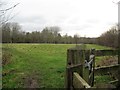
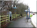
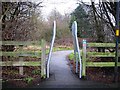
Photos of B43 6JF

Area Information
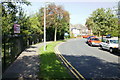
Living in B43 6JF means being part of a compact, residential cluster in the Metropolitan Borough of Sandwell, within the West Bromwich East parliamentary constituency. This postcode area covers 8.7 hectares and is home to 1,613 people, making it a densely populated yet small-scale community. The area includes neighbourhoods such as Charlemont Farm, Church Vale, and Grove Vale, with historical roots tracing back to the 18th century. Charlemont Hall, once a local landmark, was demolished in 1948, but All Saints Church, a Grade II listed Norman structure, remains a notable feature. Daily life here is shaped by its proximity to retail, transport, and local amenities, while its history as a site of housing development from the 1920s onward reflects a mix of private and council-built properties. The area’s compact size means residents are close to key services, though its small footprint also means the community is tightly knit. With a median age of 47 and a population skewed toward adults aged 30–64, it is a place of stability and established living, where historical and modern elements coexist.
- Area Type
- Postcode
- Area Size
- 8.7 hectares
- Population
- 1613
- Population Density
- 1360 people/km²
The property market in B43 6JF is largely defined by owner-occupied homes, with 86% of residents living in properties they own. This high rate of home ownership suggests a stable and long-term resident base, with limited rental activity in the area. The accommodation type is predominantly houses, which, given the postcode’s small size of 8.7 hectares, likely includes smaller terraced or semi-detached properties. The population density of 1,360 people per square kilometre further implies that housing is closely packed, potentially limiting availability for new buyers. For those considering the area, the compact nature of B43 6JF means that properties are likely to be in close proximity to amenities and transport links. However, the limited size of the postcode also means that the immediate surroundings are crucial for assessing broader housing options. Buyers should consider the area’s historical development, which includes both older council estates and newer builds, when evaluating property value and potential.
House Prices in B43 6JF
No properties found in this postcode.
Energy Efficiency in B43 6JF
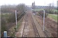
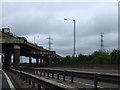
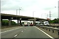
Residents of B43 6JF have access to a range of local amenities within practical reach. The area is served by five retail outlets, including Morrisons Daily, Tesco Sandwell, and Co-op Birmingham, providing convenient shopping options. Public transport is well-integrated, with railway and metro stations offering connections to nearby towns and cities. While the data does not specify parks or leisure facilities, the proximity to All Saints Church—a historical landmark—adds cultural value to the area. The presence of multiple retail and transport hubs suggests a lifestyle that balances convenience with community ties. For those seeking a mix of practicality and accessibility, the area’s amenities support daily needs without requiring long commutes. The historical character of the neighbourhood, combined with modern retail and transport options, creates a lived-in feel that appeals to those prioritising both practicality and local heritage.
Amenities
Schools
| Rank | School | Type | Entry gender | Ages |
|---|
Explore more schools in this area
Go to Schools tabDemographics
The community in B43 6JF is predominantly composed of adults aged 30–64, with a median age of 47. This suggests a mature population, likely with long-term ties to the area. Home ownership is high, with 86% of residents living in owner-occupied properties, indicating a stable and settled demographic. The accommodation type is primarily houses, reflecting a mix of private and council-built housing stock. The predominant ethnic group is White, though no specific data on diversity or deprivation is provided. The population density of 1,360 people per square kilometre highlights a compact, densely populated area, which may influence the character of local interactions and community dynamics. With no mention of socioeconomic deprivation, it is reasonable to infer that the area supports a quality of life aligned with its demographic profile, though further data would be needed to confirm this.
Household Size
Accommodation Type
Tenure
Ethnic Group
Religion
Household Composition
Age
Household Deprivation
NS-SEC
Explore more demographic insights in this area
Go to Demographics tabPlanning
Planning Constraints
- Flood RiskPremium
- Ramsar Wetland SitesPremium
- Area of Outstanding Natural BeautyPremium
- Protected Nature ReservePremium
- Protected WoodlandPremium