Area Overview for B71 3TE
Photos of B71 3TE


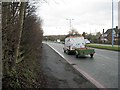
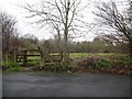
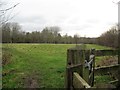
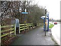
65 photos from this area
Area Information
Key information about the B71 3TE including its size, population, and administrative classification.
- Area Type
- Postcode
- Area Size
- 5.2 hectares
- Population
- 2267
- Population Density
- 5980 people/km²
House Prices in B71 3TE
37
Properties
£104,446
Average Sold Price
£28,375
Lowest Price
£270,000
Highest Price
Showing 37 properties
| Address | Type | Beds | Baths | Last Sale Price | Last Sale Date | |
|---|---|---|---|---|---|---|
| 23 Horsecroft Drive, West Bromwich, B71 3TE | Terraced | 2 | 1 | £165,000 | May 2025 | |
| 17 Horsecroft Drive, West Bromwich, B71 3TE | Semi-detached | 4 | 1 | £270,000 | Apr 2025 | |
| 36 Horsecroft Drive, West Bromwich, B71 3TE | Terraced | 2 | 1 | £175,000 | Dec 2023 | |
| 37 Horsecroft Drive, West Bromwich, B71 3TE | Terraced | 2 | 1 | £185,000 | Nov 2023 | |
| 25 Horsecroft Drive, West Bromwich, B71 3TE | Terraced | 2 | 1 | £172,000 | Feb 2023 | |
| 1 Horsecroft Drive, West Bromwich, B71 3TE | Terraced | 3 | 1 | £180,000 | Oct 2021 | |
| 35 Horsecroft Drive, West Bromwich, B71 3TE | house | - | - | £130,000 | Dec 2019 | |
| 20 Horsecroft Drive, West Bromwich, B71 3TE | Terraced | 2 | 1 | £136,000 | Sep 2018 | |
| 32 Horsecroft Drive, West Bromwich, B71 3TE | Semi-detached | 4 | - | £188,000 | Oct 2014 | |
| 28 Horsecroft Drive, West Bromwich, B71 3TE | Terraced | 3 | - | £165,000 | Aug 2014 |
Page 1 of 4
Energy Efficiency in B71 3TE
Amenities
Schools
| Rank | School | Type | Entry gender | Ages |
|---|
Explore more schools in this area
Go to Schools tabDemographics
Household Size
One person
most common
Accommodation Type
Flats
most common
Tenure
25
majority
Ethnic Group
White
most common
Religion
N/A
most common
Household Composition
N/A
most common
Age
47
median
Adults (30-64 years)
most common
Household Deprivation
N/A
with no deprivation
NS-SEC
16
in Lower managerial occupations
Explore more demographic insights in this area
Go to Demographics tabPlanning
Planning Constraints
- Flood RiskPremium
- Ramsar Wetland SitesPremium
- Area of Outstanding Natural BeautyPremium
- Protected Nature ReservePremium
- Protected WoodlandPremium