Area Overview for B42 1HN
Photos of B42 1HN
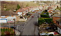
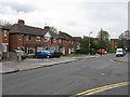
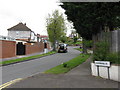
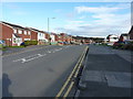
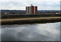
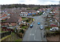
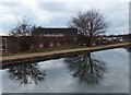
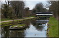
27 photos from this area
Area Information
Key information about the B42 1HN including its size, population, and administrative classification.
- Area Type
- Postcode
- Area Size
- 3077 m²
- Population
- 1662
- Population Density
- 7115 people/km²
House Prices in B42 1HN
8
Properties
£124,863
Average Sold Price
£84,950
Lowest Price
£162,000
Highest Price
Showing 8 properties
| Address | Type | Beds | Baths | Last Sale Price | Last Sale Date | |
|---|---|---|---|---|---|---|
| 199 Dyas Avenue, Birmingham, B42 1HN | Semi-detached | 3 | 1 | £162,000 | Jul 2019 | |
| 197 Dyas Avenue, Birmingham, B42 1HN | house | - | - | £128,500 | Mar 2006 | |
| 195 Dyas Avenue, Birmingham, B42 1HN | Semi-detached | - | - | £124,000 | May 2004 | |
| 201 Dyas Avenue, Birmingham, B42 1HN | house | - | - | £84,950 | Oct 2002 | |
| Flat, 203 Dyas Avenue, Birmingham, B42 1HN | Flat | - | - | - | - | |
| Flat, 207 Dyas Avenue, Birmingham, B42 1HN | Flat | - | - | - | - | |
| 209 Dyas Avenue, Birmingham, B42 1HN | Terraced | - | - | - | - | |
| Flat, 205 Dyas Avenue, Birmingham, B42 1HN | Flat | 2 | 1 | - | - |
Energy Efficiency in B42 1HN
Amenities
Schools
| Rank | School | Type | Entry gender | Ages |
|---|
Explore more schools in this area
Go to Schools tabDemographics
Household Size
Family (3-5 people)
most common
Accommodation Type
Houses
most common
Tenure
78
majority
Ethnic Group
White
most common
Religion
N/A
most common
Household Composition
N/A
most common
Age
47
median
Adults (30-64 years)
most common
Household Deprivation
N/A
with no deprivation
NS-SEC
27
in Lower managerial occupations
Explore more demographic insights in this area
Go to Demographics tabPlanning
Planning Constraints
- Flood RiskPremium
- Ramsar Wetland SitesPremium
- Area of Outstanding Natural BeautyPremium
- Protected Nature ReservePremium
- Protected WoodlandPremium