Area Overview for B37 6AJ
Photos of B37 6AJ
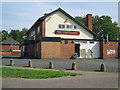
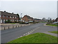
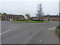
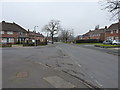
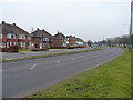
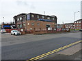
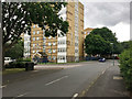
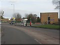
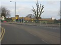


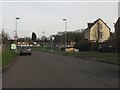
16 photos from this area
Area Information
Key information about the B37 6AJ including its size, population, and administrative classification.
- Area Type
- Postcode
- Area Size
- 1.8 hectares
- Population
- 1689
- Population Density
- 5697 people/km²
House Prices in B37 6AJ
46
Properties
£124,056
Average Sold Price
£48,000
Lowest Price
£225,000
Highest Price
Showing 46 properties
| Address | Type | Beds | Baths | Last Sale Price | Last Sale Date | |
|---|---|---|---|---|---|---|
| 64 Laburnum Avenue, Kingshurst, Solihull, B37 6AJ | Terraced | 2 | 1 | £225,000 | Oct 2025 | |
| 35 Laburnum Avenue, Kingshurst, Solihull, B37 6AJ | Terraced | 3 | 1 | £214,000 | Oct 2025 | |
| 80 Laburnum Avenue, Kingshurst, Solihull, B37 6AJ | Maisonette | - | - | £80,000 | Nov 2022 | |
| 33 Laburnum Avenue, Kingshurst, Solihull, B37 6AJ | Terraced | 3 | 1 | £185,000 | Mar 2022 | |
| 62 Laburnum Avenue, Kingshurst, Solihull, B37 6AJ | Detached | 2 | 1 | £147,000 | Jun 2021 | |
| 39 Laburnum Avenue, Kingshurst, Solihull, B37 6AJ | Terraced | 3 | 1 | £83,500 | Oct 2013 | |
| 118 Laburnum Avenue, Kingshurst, Solihull, B37 6AJ | Terraced | 3 | - | £82,000 | Sep 2013 | |
| 76 Laburnum Avenue, Kingshurst, Solihull, B37 6AJ | Maisonette | 1 | 1 | £52,000 | Feb 2009 | |
| 74 Laburnum Avenue, Kingshurst, Solihull, B37 6AJ | Maisonette | 1 | 1 | £48,000 | Jan 2004 | |
| 78 Laburnum Avenue, Kingshurst, Solihull, B37 6AJ | Flat | - | - | - | - |
Page 1 of 5
Energy Efficiency in B37 6AJ
Amenities
Schools
| Rank | School | Type | Entry gender | Ages |
|---|
Explore more schools in this area
Go to Schools tabDemographics
Household Size
Family (3-5 people)
most common
Accommodation Type
Houses
most common
Tenure
51
majority
Ethnic Group
White
most common
Religion
N/A
most common
Household Composition
N/A
most common
Age
47
median
Adults (30-64 years)
most common
Household Deprivation
N/A
with no deprivation
NS-SEC
19
in Lower managerial occupations
Explore more demographic insights in this area
Go to Demographics tabPlanning
Planning Constraints
- Flood RiskPremium
- Ramsar Wetland SitesPremium
- Area of Outstanding Natural BeautyPremium
- Protected Nature ReservePremium
- Protected WoodlandPremium