Area Overview for B34 7LH
Photos of B34 7LH
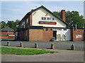
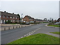
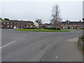
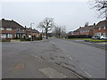
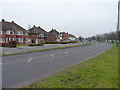
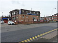
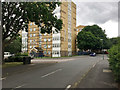
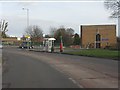

16 photos from this area
Area Information
Key information about the B34 7LH including its size, population, and administrative classification.
- Area Type
- Postcode
- Area Size
- 1.5 hectares
- Population
- 1895
- Population Density
- 5356 people/km²
House Prices in B34 7LH
42
Properties
£122,830
Average Sold Price
£43,500
Lowest Price
£245,000
Highest Price
Showing 42 properties
| Address | Type | Beds | Baths | Last Sale Price | Last Sale Date | |
|---|---|---|---|---|---|---|
| 142 Hall Hays Road, Birmingham, B34 7LH | house | 3 | 1 | £205,000 | Jul 2025 | |
| 132 Hall Hays Road, Birmingham, B34 7LH | Terraced | 3 | 1 | £245,000 | Dec 2024 | |
| 115 Hall Hays Road, Birmingham, B34 7LH | Terraced | 2 | 1 | £170,000 | Jun 2020 | |
| 119 Hall Hays Road, Birmingham, B34 7LH | house | 2 | 1 | £125,000 | Dec 2019 | |
| 121 Hall Hays Road, Birmingham, B34 7LH | Terraced | 2 | - | £140,000 | Nov 2017 | |
| 113 Hall Hays Road, Birmingham, B34 7LH | Terraced | 3 | 1 | £120,000 | Mar 2017 | |
| 152 Hall Hays Road, Birmingham, B34 7LH | Terraced | 2 | 1 | £119,950 | Apr 2015 | |
| 107 Hall Hays Road, Birmingham, B34 7LH | Terraced | 2 | 1 | £121,500 | Dec 2014 | |
| 126 Hall Hays Road, Birmingham, B34 7LH | house | - | - | £102,000 | Nov 2013 | |
| 144 Hall Hays Road, Birmingham, B34 7LH | Terraced | 2 | 1 | £87,500 | Mar 2012 |
Page 1 of 5
Energy Efficiency in B34 7LH
Amenities
Schools
| Rank | School | Type | Entry gender | Ages |
|---|
Explore more schools in this area
Go to Schools tabDemographics
Household Size
Family (3-5 people)
most common
Accommodation Type
Houses
most common
Tenure
47
majority
Ethnic Group
White
most common
Religion
N/A
most common
Household Composition
N/A
most common
Age
47
median
Adults (30-64 years)
most common
Household Deprivation
N/A
with no deprivation
NS-SEC
19
in Lower managerial occupations
Explore more demographic insights in this area
Go to Demographics tabPlanning
Planning Constraints
- Flood RiskPremium
- Ramsar Wetland SitesPremium
- Area of Outstanding Natural BeautyPremium
- Protected Nature ReservePremium
- Protected WoodlandPremium