Area Overview for B36 8JN
Photos of B36 8JN


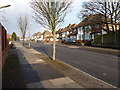

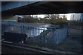
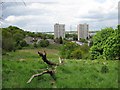
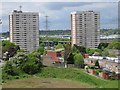

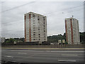

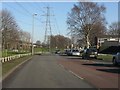
26 photos from this area
Area Information
Key information about the B36 8JN including its size, population, and administrative classification.
- Area Type
- Postcode
- Area Size
- 9738 m²
- Population
- 1987
- Population Density
- 7811 people/km²
House Prices in B36 8JN
20
Properties
£141,717
Average Sold Price
£22,950
Lowest Price
£247,000
Highest Price
Showing 20 properties
| Address | Type | Beds | Baths | Last Sale Price | Last Sale Date | |
|---|---|---|---|---|---|---|
| 6 Collingbourne Avenue, Birmingham, B36 8JN | Detached | 3 | 2 | £247,000 | Nov 2019 | |
| 14 Collingbourne Avenue, Birmingham, B36 8JN | Semi-detached | 3 | 2 | £22,950 | Oct 2016 | |
| 19 Collingbourne Avenue, Birmingham, B36 8JN | Semi-detached | 3 | 1 | £170,000 | Jun 2015 | |
| 33 Collingbourne Avenue, Birmingham, B36 8JN | Terraced | 3 | - | £155,000 | Jul 2012 | |
| 9 Collingbourne Avenue, Birmingham, B36 8JN | house | - | - | £197,000 | Nov 2011 | |
| 25 Collingbourne Avenue, Birmingham, B36 8JN | house | 3 | - | £155,000 | Jul 2011 | |
| 27 Collingbourne Avenue, Birmingham, B36 8JN | house | - | - | £184,000 | Jun 2008 | |
| 18 Collingbourne Avenue, Birmingham, B36 8JN | Detached | 5 | 1 | £180,000 | Apr 2007 | |
| 21 Collingbourne Avenue, Birmingham, B36 8JN | Terraced | - | - | £172,000 | Mar 2007 | |
| 20 Collingbourne Avenue, Birmingham, B36 8JN | Semi-detached | - | - | £197,000 | Mar 2007 |
Page 1 of 2
Energy Efficiency in B36 8JN
Amenities
Schools
| Rank | School | Type | Entry gender | Ages |
|---|
Explore more schools in this area
Go to Schools tabDemographics
Household Size
Family (3-5 people)
most common
Accommodation Type
Houses
most common
Tenure
74
majority
Ethnic Group
asian_total
most common
Religion
N/A
most common
Household Composition
N/A
most common
Age
22
median
Adults (30-64 years)
most common
Household Deprivation
N/A
with no deprivation
NS-SEC
22
in Lower managerial occupations
Explore more demographic insights in this area
Go to Demographics tabPlanning
Planning Constraints
- Flood RiskPremium
- Ramsar Wetland SitesPremium
- Area of Outstanding Natural BeautyPremium
- Protected Nature ReservePremium
- Protected WoodlandPremium