Area Overview for B36 8ET
Photos of B36 8ET


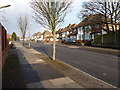
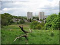
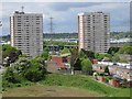
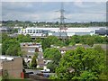
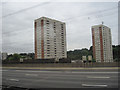
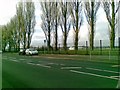
26 photos from this area
Area Information
Key information about the B36 8ET including its size, population, and administrative classification.
- Area Type
- Postcode
- Area Size
- 5321 m²
- Population
- 1987
- Population Density
- 7811 people/km²
House Prices in B36 8ET
11
Properties
£237,800
Average Sold Price
£160,000
Lowest Price
£375,000
Highest Price
Showing 11 properties
| Address | Type | Beds | Baths | Last Sale Price | Last Sale Date | |
|---|---|---|---|---|---|---|
| 329 Bromford Road, Birmingham, B36 8ET | Semi-detached | 4 | 2 | £375,000 | Nov 2025 | |
| 337 Bromford Road, Birmingham, B36 8ET | house | 3 | 1 | £310,000 | Mar 2021 | |
| 335 Bromford Road, Birmingham, B36 8ET | Semi-detached | 3 | 1 | £250,000 | Mar 2018 | |
| 333 Bromford Road, Birmingham, B36 8ET | Semi-detached | 3 | - | £270,000 | Sep 2017 | |
| 341 Bromford Road, Birmingham, B36 8ET | house | 5 | 1 | £215,000 | May 2016 | |
| 325 Bromford Road, Birmingham, B36 8ET | house | - | - | £207,000 | Nov 2010 | |
| 323 Bromford Road, Birmingham, B36 8ET | house | - | - | £186,500 | Jan 2010 | |
| 331 Bromford Road, Birmingham, B36 8ET | house | - | - | £160,000 | May 2009 | |
| 339 Bromford Road, Birmingham, B36 8ET | house | - | - | £162,500 | Apr 2009 | |
| 321 Bromford Road, Birmingham, B36 8ET | Terraced | - | - | £242,000 | May 2004 |
Page 1 of 2
Energy Efficiency in B36 8ET
Amenities
Schools
| Rank | School | Type | Entry gender | Ages |
|---|
Explore more schools in this area
Go to Schools tabDemographics
Household Size
Family (3-5 people)
most common
Accommodation Type
Houses
most common
Tenure
74
majority
Ethnic Group
asian_total
most common
Religion
N/A
most common
Household Composition
N/A
most common
Age
22
median
Adults (30-64 years)
most common
Household Deprivation
N/A
with no deprivation
NS-SEC
22
in Lower managerial occupations
Explore more demographic insights in this area
Go to Demographics tabPlanning
Planning Constraints
- Flood RiskPremium
- Ramsar Wetland SitesPremium
- Area of Outstanding Natural BeautyPremium
- Protected Nature ReservePremium
- Protected WoodlandPremium