Area Overview for B36 8AE
Photos of B36 8AE
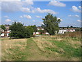
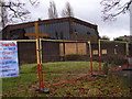
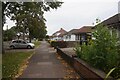
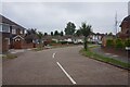
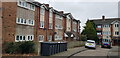
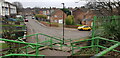
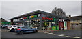
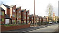

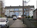
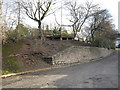
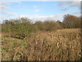
33 photos from this area
Area Information
Key information about the B36 8AE including its size, population, and administrative classification.
- Area Type
- Postcode
- Area Size
- 6.1 hectares
- Population
- 2150
- Population Density
- 3939 people/km²
House Prices in B36 8AE
15
Properties
£138,438
Average Sold Price
£63,000
Lowest Price
£298,000
Highest Price
Showing 15 properties
| Address | Type | Beds | Baths | Last Sale Price | Last Sale Date | |
|---|---|---|---|---|---|---|
| 217 Coleshill Road, Hodge Hill, Birmingham, B36 8AE | Semi-detached | 3 | - | £298,000 | Oct 2017 | |
| 221 Coleshill Road, Hodge Hill, Birmingham, B36 8AE | Semi-detached | - | - | £108,000 | Aug 2000 | |
| 213 Coleshill Road, Hodge Hill, Birmingham, B36 8AE | Detached | - | - | £84,750 | Apr 1998 | |
| 227 Coleshill Road, Hodge Hill, Birmingham, B36 8AE | hospital_care_home | - | - | £63,000 | Nov 1996 | |
| 215 Coleshill Road, Hodge Hill, Birmingham, B36 8AE | Detached | 5 | 2 | - | - | |
| Flat 1, 225 Coleshill Road, Hodge Hill, Birmingham, B36 8AE | undefined | - | - | - | - | |
| Flat 2, 225 Coleshill Road, Hodge Hill, Birmingham, B36 8AE | undefined | - | - | - | - | |
| Flat 6, 225 Coleshill Road, Hodge Hill, Birmingham, B36 8AE | undefined | - | - | - | - | |
| Flat 4, 225 Coleshill Road, Hodge Hill, Birmingham, B36 8AE | undefined | - | - | - | - | |
| Flat 3, 225 Coleshill Road, Hodge Hill, Birmingham, B36 8AE | undefined | - | - | - | - |
Page 1 of 2
Energy Efficiency in B36 8AE
Amenities
Schools
| Rank | School | Type | Entry gender | Ages |
|---|
Explore more schools in this area
Go to Schools tabDemographics
Household Size
Family (3-5 people)
most common
Accommodation Type
Houses
most common
Tenure
74
majority
Ethnic Group
asian_total
most common
Religion
N/A
most common
Household Composition
N/A
most common
Age
22
median
Adults (30-64 years)
most common
Household Deprivation
N/A
with no deprivation
NS-SEC
19
in Lower managerial occupations
Explore more demographic insights in this area
Go to Demographics tabPlanning
Planning Constraints
- Flood RiskPremium
- Ramsar Wetland SitesPremium
- Area of Outstanding Natural BeautyPremium
- Protected Nature ReservePremium
- Protected WoodlandPremium