Area Overview for B36 8ED
Photos of B36 8ED
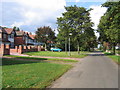
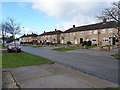
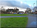
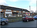
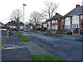
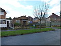
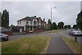
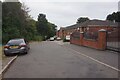
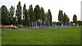
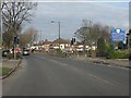
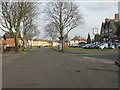
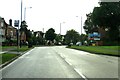
16 photos from this area
Area Information
Key information about the B36 8ED including its size, population, and administrative classification.
- Area Type
- Postcode
- Area Size
- 1.3 hectares
- Population
- 1987
- Population Density
- 7811 people/km²
House Prices in B36 8ED
20
Properties
£221,338
Average Sold Price
£66,000
Lowest Price
£319,000
Highest Price
Showing 20 properties
| Address | Type | Beds | Baths | Last Sale Price | Last Sale Date | |
|---|---|---|---|---|---|---|
| 31 Ventnor Avenue, Hodge Hill, Birmingham, B36 8ED | Semi-detached | 4 | 2 | £310,000 | Mar 2019 | |
| 28 Ventnor Avenue, Hodge Hill, Birmingham, B36 8ED | Semi-detached | 5 | 2 | £319,000 | Mar 2017 | |
| 24 Ventnor Avenue, Hodge Hill, Birmingham, B36 8ED | Semi-detached | 3 | 1 | £233,000 | Jun 2016 | |
| 35 Ventnor Avenue, Hodge Hill, Birmingham, B36 8ED | Semi-detached | 5 | 2 | £287,000 | Apr 2016 | |
| 39 Ventnor Avenue, Hodge Hill, Birmingham, B36 8ED | Semi-detached | 3 | 1 | £235,000 | Oct 2015 | |
| 9 Ventnor Avenue, Hodge Hill, Birmingham, B36 8ED | Bungalow | 3 | 1 | £235,000 | Aug 2015 | |
| 37 Ventnor Avenue, Hodge Hill, Birmingham, B36 8ED | house | - | - | £237,000 | Aug 2008 | |
| 23 Ventnor Avenue, Hodge Hill, Birmingham, B36 8ED | Semi-detached | 3 | 1 | £196,000 | Jul 2008 | |
| 33 Ventnor Avenue, Hodge Hill, Birmingham, B36 8ED | Semi-detached | - | - | £149,950 | Oct 2007 | |
| 17 Ventnor Avenue, Hodge Hill, Birmingham, B36 8ED | Semi-detached | - | - | £239,500 | May 2006 |
Page 1 of 2
Energy Efficiency in B36 8ED
Amenities
Schools
| Rank | School | Type | Entry gender | Ages |
|---|
Explore more schools in this area
Go to Schools tabDemographics
Household Size
Family (3-5 people)
most common
Accommodation Type
Houses
most common
Tenure
74
majority
Ethnic Group
asian_total
most common
Religion
N/A
most common
Household Composition
N/A
most common
Age
22
median
Adults (30-64 years)
most common
Household Deprivation
N/A
with no deprivation
NS-SEC
22
in Lower managerial occupations
Explore more demographic insights in this area
Go to Demographics tabPlanning
Planning Constraints
- Flood RiskPremium
- Ramsar Wetland SitesPremium
- Area of Outstanding Natural BeautyPremium
- Protected Nature ReservePremium
- Protected WoodlandPremium