Area Overview for B34 7JE
Photos of B34 7JE
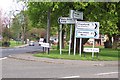
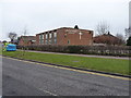

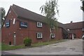
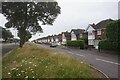
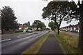
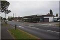
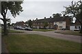
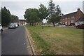

30 photos from this area
Area Information
Key information about the B34 7JE including its size, population, and administrative classification.
- Area Type
- Postcode
- Area Size
- 4294 m²
- Population
- 1849
- Population Density
- 5350 people/km²
House Prices in B34 7JE
18
Properties
£93,804
Average Sold Price
£23,750
Lowest Price
£177,500
Highest Price
Showing 18 properties
| Address | Type | Beds | Baths | Last Sale Price | Last Sale Date | |
|---|---|---|---|---|---|---|
| 29 Brookbank Avenue, Birmingham, B34 7JE | Maisonette | 1 | 1 | £110,000 | Dec 2021 | |
| 25 Brookbank Avenue, Birmingham, B34 7JE | Semi-detached | 2 | - | £177,500 | Sep 2021 | |
| 43 Brookbank Avenue, Birmingham, B34 7JE | Terraced | 2 | - | £169,000 | Jan 2021 | |
| 38 Brookbank Avenue, Birmingham, B34 7JE | Semi-detached | 2 | 1 | £84,500 | Jun 2020 | |
| 33 Brookbank Avenue, Birmingham, B34 7JE | Terraced | 2 | 1 | £160,000 | Oct 2019 | |
| 40 Brookbank Avenue, Birmingham, B34 7JE | Semi-detached | 2 | 1 | £154,000 | Feb 2019 | |
| 31 Brookbank Avenue, Birmingham, B34 7JE | Maisonette | - | - | £71,500 | Sep 2012 | |
| 47 Brookbank Avenue, Birmingham, B34 7JE | Semi-detached | - | - | £125,000 | Oct 2006 | |
| 45 Brookbank Avenue, Birmingham, B34 7JE | Terraced | - | - | £65,500 | Oct 2006 | |
| 21 Brookbank Avenue, Birmingham, B34 7JE | house | - | - | £47,500 | Dec 2003 |
Page 1 of 2
Energy Efficiency in B34 7JE
Amenities
Schools
| Rank | School | Type | Entry gender | Ages |
|---|
Explore more schools in this area
Go to Schools tabDemographics
Household Size
One person
most common
Accommodation Type
Houses
most common
Tenure
53
majority
Ethnic Group
White
most common
Religion
N/A
most common
Household Composition
N/A
most common
Age
47
median
Adults (30-64 years)
most common
Household Deprivation
N/A
with no deprivation
NS-SEC
20
in Lower managerial occupations
Explore more demographic insights in this area
Go to Demographics tabPlanning
Planning Constraints
- Flood RiskPremium
- Ramsar Wetland SitesPremium
- Area of Outstanding Natural BeautyPremium
- Protected Nature ReservePremium
- Protected WoodlandPremium