Area Overview for B34 6EE
Photos of B34 6EE
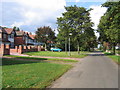
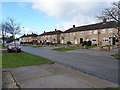
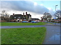
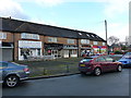
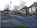
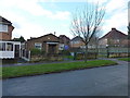
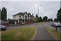
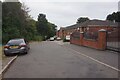

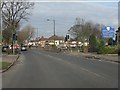
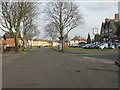
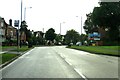
16 photos from this area
Area Information
Key information about the B34 6EE including its size, population, and administrative classification.
- Area Type
- Postcode
- Area Size
- 11.8 hectares
- Population
- 1791
- Population Density
- 4996 people/km²
House Prices in B34 6EE
56
Properties
£170,684
Average Sold Price
£58,500
Lowest Price
£282,500
Highest Price
Showing 56 properties
| Address | Type | Beds | Baths | Last Sale Price | Last Sale Date | |
|---|---|---|---|---|---|---|
| 39 Maryland Avenue, Birmingham, B34 6EE | Semi-detached | 3 | 1 | £265,000 | Aug 2023 | |
| 62 Maryland Avenue, Birmingham, B34 6EE | Retail | 3 | 1 | £282,500 | Apr 2022 | |
| 26 Maryland Avenue, Birmingham, B34 6EE | Semi-detached | 3 | 1 | £280,000 | Sep 2021 | |
| 83 Maryland Avenue, Birmingham, B34 6EE | house | - | - | £230,000 | Aug 2021 | |
| 85 Maryland Avenue, Birmingham, B34 6EE | house | - | - | £230,000 | Aug 2021 | |
| 52 Maryland Avenue, Birmingham, B34 6EE | house | 3 | - | £225,000 | Oct 2020 | |
| 60 Maryland Avenue, Birmingham, B34 6EE | Semi-detached | 3 | 2 | £260,000 | Aug 2020 | |
| 36 Maryland Avenue, Birmingham, B34 6EE | Semi-detached | 3 | 1 | £220,000 | Mar 2020 | |
| 53 Maryland Avenue, Birmingham, B34 6EE | Semi-detached | 3 | 1 | £232,000 | Oct 2018 | |
| 55 Maryland Avenue, Birmingham, B34 6EE | Semi-detached | 3 | 1 | £227,000 | Jul 2018 |
Page 1 of 6
Energy Efficiency in B34 6EE
Amenities
Schools
| Rank | School | Type | Entry gender | Ages |
|---|
Explore more schools in this area
Go to Schools tabDemographics
Household Size
Family (3-5 people)
most common
Accommodation Type
Houses
most common
Tenure
83
majority
Ethnic Group
asian_total
most common
Religion
N/A
most common
Household Composition
N/A
most common
Age
47
median
Adults (30-64 years)
most common
Household Deprivation
N/A
with no deprivation
NS-SEC
21
in Lower managerial occupations
Explore more demographic insights in this area
Go to Demographics tabPlanning
Planning Constraints
- Flood RiskPremium
- Ramsar Wetland SitesPremium
- Area of Outstanding Natural BeautyPremium
- Protected Nature ReservePremium
- Protected WoodlandPremium