Area Overview for B33 9SN
Photos of B33 9SN
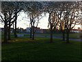
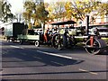
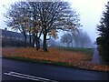
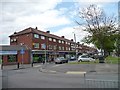
43 photos from this area
Area Information
Key information about the B33 9SN including its size, population, and administrative classification.
- Area Type
- Postcode
- Area Size
- 9326 m²
- Population
- 1937
- Population Density
- 3512 people/km²
House Prices in B33 9SN
9
Properties
£97,889
Average Sold Price
£79,500
Lowest Price
£150,000
Highest Price
Showing 9 properties
| Address | Type | Beds | Baths | Last Sale Price | Last Sale Date | |
|---|---|---|---|---|---|---|
| 26 Cliffe Drive, Birmingham, B33 9SN | house | - | - | £150,000 | Dec 2022 | |
| 30 Cliffe Drive, Birmingham, B33 9SN | Terraced | 3 | 1 | £128,000 | May 2017 | |
| 28 Cliffe Drive, Birmingham, B33 9SN | house | - | - | £79,500 | Nov 2016 | |
| 18 Cliffe Drive, Birmingham, B33 9SN | house | - | - | £87,000 | Nov 2016 | |
| 20 Cliffe Drive, Birmingham, B33 9SN | Terraced | 3 | 1 | £83,000 | Mar 2015 | |
| 22 Cliffe Drive, Birmingham, B33 9SN | house | 2 | - | £97,500 | Jun 2014 | |
| 14 Cliffe Drive, Birmingham, B33 9SN | Terraced | 2 | 1 | £80,000 | Sep 2007 | |
| 12 Cliffe Drive, Birmingham, B33 9SN | Terraced | 3 | 1 | £90,000 | Sep 2005 | |
| 16 Cliffe Drive, Birmingham, B33 9SN | Terraced | - | - | £86,000 | Jun 2004 |
Energy Efficiency in B33 9SN
Amenities
Schools
| Rank | School | Type | Entry gender | Ages |
|---|
Explore more schools in this area
Go to Schools tabDemographics
Household Size
Family (3-5 people)
most common
Accommodation Type
Houses
most common
Tenure
39
majority
Ethnic Group
White
most common
Religion
N/A
most common
Household Composition
N/A
most common
Age
47
median
Adults (30-64 years)
most common
Household Deprivation
N/A
with no deprivation
NS-SEC
17
in Lower managerial occupations
Explore more demographic insights in this area
Go to Demographics tabPlanning
Planning Constraints
- Flood RiskPremium
- Ramsar Wetland SitesPremium
- Area of Outstanding Natural BeautyPremium
- Protected Nature ReservePremium
- Protected WoodlandPremium