Area Overview for B33 9SA
Photos of B33 9SA

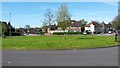
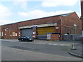
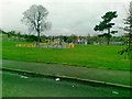
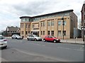
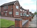
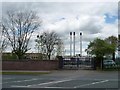

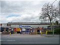
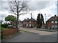
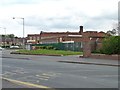
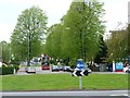
21 photos from this area
Area Information
Key information about the B33 9SA including its size, population, and administrative classification.
- Area Type
- Postcode
- Area Size
- 1.6 hectares
- Population
- 1937
- Population Density
- 3512 people/km²
House Prices in B33 9SA
43
Properties
£131,463
Average Sold Price
£37,000
Lowest Price
£255,000
Highest Price
Showing 43 properties
| Address | Type | Beds | Baths | Last Sale Price | Last Sale Date | |
|---|---|---|---|---|---|---|
| 213 Kitts Green Road, Birmingham, B33 9SA | Terraced | 4 | 2 | £255,000 | Mar 2023 | |
| 257 Kitts Green Road, Birmingham, B33 9SA | Terraced | 2 | 1 | £171,000 | Jan 2023 | |
| 209 Kitts Green Road, Birmingham, B33 9SA | Semi-detached | 3 | 1 | £220,000 | Sep 2022 | |
| 203 Kitts Green Road, Birmingham, B33 9SA | Semi-detached | 1 | 3 | £200,000 | Jun 2022 | |
| 235 Kitts Green Road, Birmingham, B33 9SA | Retail | 3 | 1 | £167,000 | Jan 2022 | |
| 233 Kitts Green Road, Birmingham, B33 9SA | house | 3 | 1 | £168,000 | Aug 2021 | |
| 243 Kitts Green Road, Birmingham, B33 9SA | Terraced | 3 | 1 | £145,000 | Oct 2018 | |
| 229 Kitts Green Road, Birmingham, B33 9SA | Terraced | 3 | 1 | £128,950 | Feb 2016 | |
| 273 Kitts Green Road, Birmingham, B33 9SA | house | 3 | 1 | £74,000 | Mar 2015 | |
| 205 Kitts Green Road, Birmingham, B33 9SA | Semi-detached | 3 | 1 | £98,000 | Jan 2014 |
Page 1 of 5
Energy Efficiency in B33 9SA
Amenities
Schools
| Rank | School | Type | Entry gender | Ages |
|---|
Explore more schools in this area
Go to Schools tabDemographics
Household Size
Family (3-5 people)
most common
Accommodation Type
Houses
most common
Tenure
39
majority
Ethnic Group
White
most common
Religion
N/A
most common
Household Composition
N/A
most common
Age
47
median
Adults (30-64 years)
most common
Household Deprivation
N/A
with no deprivation
NS-SEC
17
in Lower managerial occupations
Explore more demographic insights in this area
Go to Demographics tabPlanning
Planning Constraints
- Flood RiskPremium
- Ramsar Wetland SitesPremium
- Area of Outstanding Natural BeautyPremium
- Protected Nature ReservePremium
- Protected WoodlandPremium