Area Overview for B33 9NG
Photos of B33 9NG
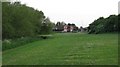
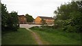
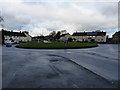
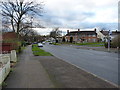
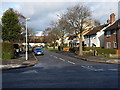
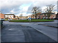
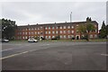
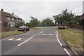
20 photos from this area
Area Information
Key information about the B33 9NG including its size, population, and administrative classification.
- Area Type
- Postcode
- Area Size
- 1.2 hectares
- Population
- 1677
- Population Density
- 3669 people/km²
House Prices in B33 9NG
47
Properties
£111,097
Average Sold Price
£55,000
Lowest Price
£200,000
Highest Price
Showing 47 properties
| Address | Type | Beds | Baths | Last Sale Price | Last Sale Date | |
|---|---|---|---|---|---|---|
| 16 Bushbury Road, Birmingham, B33 9NG | Terraced | 3 | 1 | £190,000 | Jun 2024 | |
| 54 Bushbury Road, Birmingham, B33 9NG | Terraced | 2 | 1 | £200,000 | Aug 2023 | |
| 14 Bushbury Road, Birmingham, B33 9NG | Terraced | 3 | 1 | £144,800 | Aug 2023 | |
| 18 Bushbury Road, Birmingham, B33 9NG | Terraced | 2 | 1 | £145,000 | Jan 2021 | |
| 8 Bushbury Road, Birmingham, B33 9NG | Flat | 1 | 1 | £128,000 | Sep 2020 | |
| 15B Bushbury Road, Birmingham, B33 9NG | Maisonette | 1 | 1 | £68,000 | Sep 2019 | |
| 20 Bushbury Road, Birmingham, B33 9NG | Terraced | 2 | 1 | £120,000 | Oct 2017 | |
| 7 Bushbury Road, Birmingham, B33 9NG | Semi-detached | 2 | 1 | £112,000 | Feb 2017 | |
| 30 Bushbury Road, Birmingham, B33 9NG | Semi-detached | 2 | 1 | £88,000 | Jul 2016 | |
| 3 Bushbury Road, Birmingham, B33 9NG | Terraced | 2 | 1 | £120,000 | Jun 2016 |
Page 1 of 5
Energy Efficiency in B33 9NG
Amenities
Schools
| Rank | School | Type | Entry gender | Ages |
|---|
Explore more schools in this area
Go to Schools tabDemographics
Household Size
Family (3-5 people)
most common
Accommodation Type
Houses
most common
Tenure
52
majority
Ethnic Group
White
most common
Religion
N/A
most common
Household Composition
N/A
most common
Age
47
median
Adults (30-64 years)
most common
Household Deprivation
N/A
with no deprivation
NS-SEC
18
in Lower managerial occupations
Explore more demographic insights in this area
Go to Demographics tabPlanning
Planning Constraints
- Flood RiskPremium
- Ramsar Wetland SitesPremium
- Area of Outstanding Natural BeautyPremium
- Protected Nature ReservePremium
- Protected WoodlandPremium