Area Overview for B33 9NE
Photos of B33 9NE
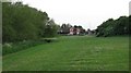
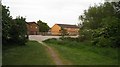
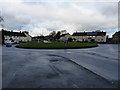
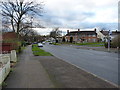
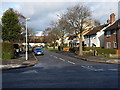
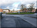
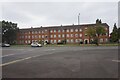
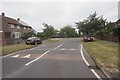
20 photos from this area
Area Information
Key information about the B33 9NE including its size, population, and administrative classification.
- Area Type
- Postcode
- Area Size
- 3839 m²
- Population
- 1677
- Population Density
- 3669 people/km²
House Prices in B33 9NE
15
Properties
£97,190
Average Sold Price
£47,000
Lowest Price
£175,000
Highest Price
Showing 15 properties
| Address | Type | Beds | Baths | Last Sale Price | Last Sale Date | |
|---|---|---|---|---|---|---|
| 131 Glebe Farm Road, Birmingham, B33 9NE | Detached | 3 | 1 | £175,000 | Mar 2021 | |
| 129 Glebe Farm Road, Birmingham, B33 9NE | Semi-detached | 3 | - | £96,000 | Feb 2014 | |
| 123 Glebe Farm Road, Birmingham, B33 9NE | Terraced | - | - | £88,000 | May 2004 | |
| 125 Glebe Farm Road, Birmingham, B33 9NE | house | - | - | £79,950 | Oct 2003 | |
| 133 Glebe Farm Road, Birmingham, B33 9NE | Semi-detached | 3 | 1 | £47,000 | Feb 1999 | |
| Birmingham Notors Sales Ltd, Land Between 57 And 65, Glebe Farm Road, Birmingham, B33 9NE | commercial | - | - | - | - | |
| 127 Glebe Farm Road, Birmingham, B33 9NE | house | - | - | - | - | |
| 135 Glebe Farm Road, Birmingham, B33 9NE | Detached | - | - | - | - | |
| 115 Glebe Farm Road, Birmingham, B33 9NE | Flat | - | - | - | - | |
| 113 Glebe Farm Road, Birmingham, B33 9NE | house | - | - | - | - |
Page 1 of 2
Energy Efficiency in B33 9NE
Amenities
Schools
| Rank | School | Type | Entry gender | Ages |
|---|
Explore more schools in this area
Go to Schools tabDemographics
Household Size
Family (3-5 people)
most common
Accommodation Type
Houses
most common
Tenure
52
majority
Ethnic Group
White
most common
Religion
N/A
most common
Household Composition
N/A
most common
Age
47
median
Adults (30-64 years)
most common
Household Deprivation
N/A
with no deprivation
NS-SEC
18
in Lower managerial occupations
Explore more demographic insights in this area
Go to Demographics tabPlanning
Planning Constraints
- Flood RiskPremium
- Ramsar Wetland SitesPremium
- Area of Outstanding Natural BeautyPremium
- Protected Nature ReservePremium
- Protected WoodlandPremium