Area Overview for B33 8NY
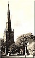
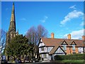
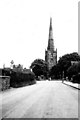
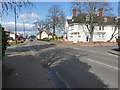
Photos of B33 8NY


Area Information
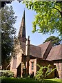
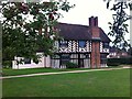
B33 8NY is a small residential cluster located within the Yardley East Ward of east Birmingham. This postcode covers just 7,640 square metres, yet it supports a population of 1,701 people. The location sits in the eastern part of Birmingham's urban area, offering a snapshot of life in an established part of the West Midlands. Homebuyers here live in a district with a deep history, tracing back to King Edgar's Charter in 972 AD when it was named Gyrdleah. The area transitioned from open countryside to a bustling suburb in the 20th century, eventually becoming part of Greater Birmingham in 1911. Today, the ward contains a mix of Victorian terraced houses and large municipal estates built during the 1920s and 1930s. You are living in an area where commerce and historic heritage coexist, featuring landmarks like Blakesley Hall from 1590 and the medieval Kent's Moat. Daily life in B33 8NY is characterised by a tight-knit community feel within a larger suburban framework. The specific coordinates place you near key routes such as Coventry Road and Stratford Road. This postcode offers the convenience of city access while retaining elements of a traditional residential neighbourhood that has shaped itself over more than a millennium.
- Area Type
- Postcode
- Area Size
- 7640 m²
- Population
- 1701
- Population Density
- 5139 people/km²
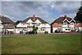
The property market in B33 8NY is defined by a strong preference for houses and home ownership. Sixty-three percent of residents are homeowners, which creates a stable market where families often pass on properties through generations. Almost exclusively, homes in this postcode are detached or semi-detached houses, with no significant presence of flats or apartments recorded for this cluster. This means you will primarily be looking at traditional family homes when buying or selling here. The accommodation type is consistently listed as houses, reflecting the historical development of the Yardley East Ward. Because the area contains a mix of Victorian terraces and extensive municipal estates built in the 1920s and 1930s, the quality and style of housing will vary significantly. The Marlborough Farm and Fast Pits estates, for example, comprise over 2,000 houses and contribute to the housing stock in the wider local area. Living in B33 8NY involves navigating a market that values ownership and provides a wide variety of house styles. Buyers can expect a serious market focused on private residential properties rather than student rentals or high-rise flats.
House Prices in B33 8NY
Showing 6 properties
| Address | Type | Beds | Baths | Last Sale Price | Last Sale Date | |
|---|---|---|---|---|---|---|
| 445 Church Road, Stechford And Yardley North, Birmingham, B33 8NY | house | 2 | 1 | £136,000 | Nov 2018 | |
| 447 Church Road, Stechford And Yardley North, Birmingham, B33 8NY | Terraced | - | - | £63,500 | Sep 1999 | |
| 449A Church Road, Stechford And Yardley North, Birmingham, B33 8NY | house | 2 | - | - | - | |
| 451 Church Road, Stechford And Yardley North, Birmingham, B33 8NY | Cottage | 3 | 1 | - | - | |
| 449 Church Road, Stechford And Yardley North, Birmingham, B33 8NY | house | - | - | - | - | |
| Yardley Grange Nursing Home, 465 Church Road, Stechford And Yardley North, Birmingham, B33 8NY | Retirement | - | - | - | - |
Energy Efficiency in B33 8NY
Your lifestyle in B33 8NY benefits from immediate access to a range of essential amenities and transport hubs. Five retail outlets are located within practical reach, including Asda Sheldon, Iceland Yardley, and Co-op Yardley. These supermarkets ensure you do not need to travel far for large household shopping or weekly grocery runs. Convenience shopping is integrated directly into the fabric of the local area. For daily travel, residents can access five nearby rail stations, including Acocks Green Railway Station and Stechford Railway Station. If you require long-distance travel, Birmingham International Airport and Birmingham Intl Railway Station are also noted as being near your postcode. This proximity to Bull Street and the city's transport network means you can plan commutes or holidays with confidence regarding connection points. The specific locations of Asda and Iceland mean that everyday errands are solved with minimal effort. Living in B33 8NY allows you to maintain a suburban routine while keeping the city's major amenities within easy striking distance.
Amenities
Schools
| Rank | School | Type | Entry gender | Ages |
|---|
Explore more schools in this area
Go to Schools tabDemographics
The community in B33 8NY has a distinct age profile, with a median age of 47 years. The most common age range for residents is adults between 30 and 64 years. This demographic suggests a neighbourhood dominated by families and established adults rather than students or young professionals. House ownership stands at 63% within this cluster. That figure indicates a predominantly owner-occupied area where long-term residents hold a significant stake in their properties. Almost all residents live in houses, and the data does not indicate significant shares of flats or apartments in this specific cluster. The predominant ethnic group is White, which aligns with the demographics of many parts of east Birmingham. Because the population is concentrated in a relatively small footprint of 7,640 square metres, the sense of community is likely very local. The high home ownership rate implies stability, as evidenced by 63 percent of households having secured title to their dwellings. You are looking at a mature community where the majority of occupants are settled in family-sized homes.
Household Size
Accommodation Type
Tenure
Ethnic Group
Religion
Household Composition
Age
Household Deprivation
NS-SEC
Explore more demographic insights in this area
Go to Demographics tabPlanning
Planning Constraints
- Flood RiskPremium
- Ramsar Wetland SitesPremium
- Area of Outstanding Natural BeautyPremium
- Protected Nature ReservePremium
- Protected WoodlandPremium