Area Overview for B32 4LF
Photos of B32 4LF
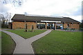
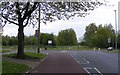
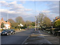
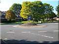
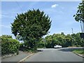
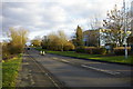
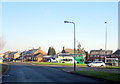
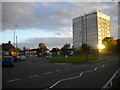
18 photos from this area
Area Information
Key information about the B32 4LF including its size, population, and administrative classification.
- Area Type
- Postcode
- Area Size
- 7802 m²
- Population
- 1176
- Population Density
- 4621 people/km²
House Prices in B32 4LF
35
Properties
£116,610
Average Sold Price
£47,000
Lowest Price
£170,000
Highest Price
Showing 35 properties
| Address | Type | Beds | Baths | Last Sale Price | Last Sale Date | |
|---|---|---|---|---|---|---|
| 59 Pinewood Drive, Birmingham, B32 4LF | Terraced | 3 | 1 | £167,500 | Aug 2020 | |
| 75 Pinewood Drive, Birmingham, B32 4LF | house | - | - | £170,000 | May 2020 | |
| 23 Pinewood Drive, Birmingham, B32 4LF | Flat | 2 | 1 | £98,000 | Aug 2019 | |
| 51 Pinewood Drive, Birmingham, B32 4LF | Semi-detached | 3 | 1 | £159,999 | Aug 2019 | |
| 73 Pinewood Drive, Birmingham, B32 4LF | Semi-detached | 3 | 1 | £165,000 | May 2018 | |
| 41 Pinewood Drive, Birmingham, B32 4LF | house | - | - | £137,000 | Mar 2016 | |
| 35 Pinewood Drive, Birmingham, B32 4LF | Maisonette | 2 | 1 | £84,500 | Jan 2014 | |
| 69 Pinewood Drive, Birmingham, B32 4LF | Semi-detached | - | - | £147,000 | Nov 2012 | |
| 77 Pinewood Drive, Birmingham, B32 4LF | house | - | - | £134,000 | Jul 2010 | |
| 27 Pinewood Drive, Birmingham, B32 4LF | Flat | - | - | £82,500 | Mar 2010 |
Page 1 of 4
Energy Efficiency in B32 4LF
Amenities
Schools
| Rank | School | Type | Entry gender | Ages |
|---|
Explore more schools in this area
Go to Schools tabDemographics
Household Size
Two person
most common
Accommodation Type
Houses
most common
Tenure
89
majority
Ethnic Group
White
most common
Religion
N/A
most common
Household Composition
N/A
most common
Age
47
median
Adults (30-64 years)
most common
Household Deprivation
N/A
with no deprivation
NS-SEC
28
in Lower managerial occupations
Explore more demographic insights in this area
Go to Demographics tabPlanning
Planning Constraints
- Flood RiskPremium
- Ramsar Wetland SitesPremium
- Area of Outstanding Natural BeautyPremium
- Protected Nature ReservePremium
- Protected WoodlandPremium