Area Overview for B32 4LE
Photos of B32 4LE
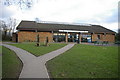
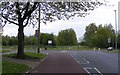
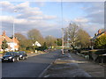
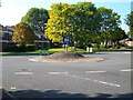
18 photos from this area
Area Information
Key information about the B32 4LE including its size, population, and administrative classification.
- Area Type
- Postcode
- Area Size
- 5676 m²
- Population
- 1176
- Population Density
- 4621 people/km²
House Prices in B32 4LE
22
Properties
£116,504
Average Sold Price
£65,000
Lowest Price
£190,000
Highest Price
Showing 22 properties
| Address | Type | Beds | Baths | Last Sale Price | Last Sale Date | |
|---|---|---|---|---|---|---|
| 45 Westcombe Grove, Birmingham, B32 4LE | Maisonette | 2 | 1 | £147,000 | Oct 2023 | |
| 15 Westcombe Grove, Birmingham, B32 4LE | house | - | - | £190,000 | Jan 2023 | |
| 25 Westcombe Grove, Birmingham, B32 4LE | Flat | 2 | 1 | £135,000 | Nov 2022 | |
| 23 Westcombe Grove, Birmingham, B32 4LE | Maisonette | - | - | £118,500 | Jul 2022 | |
| 11 Westcombe Grove, Birmingham, B32 4LE | house | - | - | £170,000 | Jun 2021 | |
| 12 Westcombe Grove, Birmingham, B32 4LE | Terraced | 3 | 1 | £170,000 | Jan 2021 | |
| 31 Westcombe Grove, Birmingham, B32 4LE | Flat | - | - | £95,000 | Nov 2018 | |
| 27 Westcombe Grove, Birmingham, B32 4LE | Maisonette | 2 | - | £87,000 | May 2017 | |
| 39 Westcombe Grove, Birmingham, B32 4LE | Maisonette | 2 | 1 | £88,000 | Mar 2016 | |
| 35 Westcombe Grove, Birmingham, B32 4LE | Maisonette | - | - | £80,000 | Jul 2015 |
Page 1 of 3
Energy Efficiency in B32 4LE
Amenities
Schools
| Rank | School | Type | Entry gender | Ages |
|---|
Explore more schools in this area
Go to Schools tabDemographics
Household Size
Two person
most common
Accommodation Type
Houses
most common
Tenure
89
majority
Ethnic Group
White
most common
Religion
N/A
most common
Household Composition
N/A
most common
Age
47
median
Adults (30-64 years)
most common
Household Deprivation
N/A
with no deprivation
NS-SEC
28
in Lower managerial occupations
Explore more demographic insights in this area
Go to Demographics tabPlanning
Planning Constraints
- Flood RiskPremium
- Ramsar Wetland SitesPremium
- Area of Outstanding Natural BeautyPremium
- Protected Nature ReservePremium
- Protected WoodlandPremium