Area Overview for B32 2TA
Photos of B32 2TA
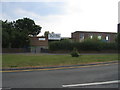
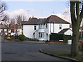
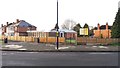
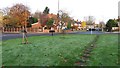
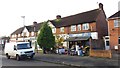
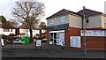
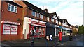
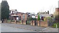
27 photos from this area
Area Information
Key information about the B32 2TA including its size, population, and administrative classification.
- Area Type
- Postcode
- Area Size
- 1.1 hectares
- Population
- 1677
- Population Density
- 6738 people/km²
House Prices in B32 2TA
28
Properties
£149,972
Average Sold Price
£48,000
Lowest Price
£290,000
Highest Price
Showing 28 properties
| Address | Type | Beds | Baths | Last Sale Price | Last Sale Date | |
|---|---|---|---|---|---|---|
| 30 Glyn Road, Birmingham, B32 2TA | Semi-detached | 3 | 1 | £235,000 | Nov 2022 | |
| 64 Glyn Road, Birmingham, B32 2TA | house | 3 | - | £290,000 | Jun 2022 | |
| 26 Glyn Road, Birmingham, B32 2TA | Semi-detached | 3 | 1 | £200,000 | Jan 2021 | |
| 42 Glyn Road, Birmingham, B32 2TA | house | - | - | £202,500 | Oct 2020 | |
| 18 Glyn Road, Birmingham, B32 2TA | Semi-detached | 3 | - | £210,000 | Sep 2017 | |
| 36 Glyn Road, Birmingham, B32 2TA | house | - | - | £145,000 | Nov 2015 | |
| 62 Glyn Road, Birmingham, B32 2TA | Semi-detached | 3 | 2 | £151,000 | Sep 2013 | |
| 14 Glyn Road, Birmingham, B32 2TA | house | - | - | £124,500 | Dec 2012 | |
| 40 Glyn Road, Birmingham, B32 2TA | Semi-detached | - | - | £159,000 | Aug 2007 | |
| 56 Glyn Road, Birmingham, B32 2TA | Terraced | - | - | £160,000 | Aug 2006 |
Page 1 of 3
Energy Efficiency in B32 2TA
Amenities
Schools
| Rank | School | Type | Entry gender | Ages |
|---|
Explore more schools in this area
Go to Schools tabDemographics
Household Size
Family (3-5 people)
most common
Accommodation Type
Houses
most common
Tenure
61
majority
Ethnic Group
White
most common
Religion
N/A
most common
Household Composition
N/A
most common
Age
47
median
Adults (30-64 years)
most common
Household Deprivation
N/A
with no deprivation
NS-SEC
29
in Lower managerial occupations
Explore more demographic insights in this area
Go to Demographics tabPlanning
Planning Constraints
- Flood RiskPremium
- Ramsar Wetland SitesPremium
- Area of Outstanding Natural BeautyPremium
- Protected Nature ReservePremium
- Protected WoodlandPremium