Area Overview for B32 2EX
Photos of B32 2EX
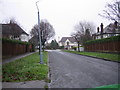
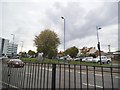
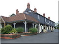
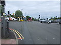
18 photos from this area
Area Information
Key information about the B32 2EX including its size, population, and administrative classification.
- Area Type
- Postcode
- Area Size
- 1.0 hectares
- Population
- 1747
- Population Density
- 4924 people/km²
House Prices in B32 2EX
28
Properties
£267,458
Average Sold Price
£74,500
Lowest Price
£420,000
Highest Price
Showing 28 properties
| Address | Type | Beds | Baths | Last Sale Price | Last Sale Date | |
|---|---|---|---|---|---|---|
| 9 Norman Avenue, Birmingham, B32 2EX | Semi-detached | 3 | 1 | £375,000 | Mar 2025 | |
| 12 Norman Avenue, Birmingham, B32 2EX | Semi-detached | - | - | £370,000 | Jul 2023 | |
| 35 Norman Avenue, Birmingham, B32 2EX | Semi-detached | 3 | 1 | £378,000 | Sep 2022 | |
| 11 Norman Avenue, Birmingham, B32 2EX | house | - | - | £355,750 | Sep 2022 | |
| 25 Norman Avenue, Birmingham, B32 2EX | Semi-detached | 3 | 1 | £317,000 | Sep 2021 | |
| 28 Norman Avenue, Birmingham, B32 2EX | house | - | - | £420,000 | Aug 2021 | |
| 37 Norman Avenue, Birmingham, B32 2EX | Semi-detached | 3 | 1 | £350,000 | Sep 2020 | |
| 34 Norman Avenue, Birmingham, B32 2EX | Semi-detached | 5 | 1 | £405,000 | May 2018 | |
| 32 Norman Avenue, Birmingham, B32 2EX | Semi-detached | 3 | 1 | £240,000 | Apr 2017 | |
| 26 Norman Avenue, Birmingham, B32 2EX | Semi-detached | 5 | 1 | £375,000 | Feb 2017 |
Page 1 of 3
Energy Efficiency in B32 2EX
Amenities
Schools
| Rank | School | Type | Entry gender | Ages |
|---|
Explore more schools in this area
Go to Schools tabDemographics
Household Size
Family (3-5 people)
most common
Accommodation Type
Houses
most common
Tenure
77
majority
Ethnic Group
White
most common
Religion
N/A
most common
Household Composition
N/A
most common
Age
47
median
Adults (30-64 years)
most common
Household Deprivation
N/A
with no deprivation
NS-SEC
42
in Lower managerial occupations
Explore more demographic insights in this area
Go to Demographics tabPlanning
Planning Constraints
- Flood RiskPremium
- Ramsar Wetland SitesPremium
- Area of Outstanding Natural BeautyPremium
- Protected Nature ReservePremium
- Protected WoodlandPremium