Area Overview for B32 2EP
Photos of B32 2EP
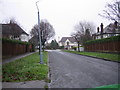
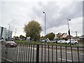
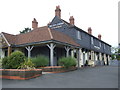
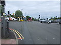
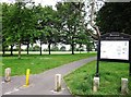
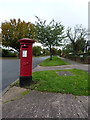
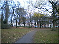
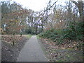
18 photos from this area
Area Information
Key information about the B32 2EP including its size, population, and administrative classification.
- Area Type
- Postcode
- Area Size
- 5031 m²
- Population
- 1747
- Population Density
- 4924 people/km²
House Prices in B32 2EP
18
Properties
£194,826
Average Sold Price
£75,000
Lowest Price
£350,000
Highest Price
Showing 18 properties
| Address | Type | Beds | Baths | Last Sale Price | Last Sale Date | |
|---|---|---|---|---|---|---|
| 152 Balden Road, Birmingham, B32 2EP | Semi-detached | 2 | 1 | £262,500 | Dec 2023 | |
| 128 Balden Road, Birmingham, B32 2EP | Terraced | 2 | 1 | £350,000 | Oct 2023 | |
| 134 Balden Road, Birmingham, B32 2EP | Terraced | 2 | 1 | £240,000 | May 2023 | |
| 156 Balden Road, Birmingham, B32 2EP | house | - | - | £240,500 | Nov 2022 | |
| 132 Balden Road, Birmingham, B32 2EP | Terraced | 2 | 1 | £240,000 | Nov 2021 | |
| 154 Balden Road, Birmingham, B32 2EP | house | 2 | 1 | £221,000 | Jan 2021 | |
| 136 Balden Road, Birmingham, B32 2EP | Semi-detached | 3 | 1 | £318,000 | Jul 2018 | |
| 158 Balden Road, Birmingham, B32 2EP | house | 2 | 1 | £255,000 | Jan 2018 | |
| 162 Balden Road, Birmingham, B32 2EP | Terraced | 2 | 2 | £156,500 | Feb 2016 | |
| 168 Balden Road, Birmingham, B32 2EP | house | 2 | - | £132,500 | Apr 2015 |
Page 1 of 2
Energy Efficiency in B32 2EP
Amenities
Schools
| Rank | School | Type | Entry gender | Ages |
|---|
Explore more schools in this area
Go to Schools tabDemographics
Household Size
Family (3-5 people)
most common
Accommodation Type
Houses
most common
Tenure
77
majority
Ethnic Group
White
most common
Religion
N/A
most common
Household Composition
N/A
most common
Age
47
median
Adults (30-64 years)
most common
Household Deprivation
N/A
with no deprivation
NS-SEC
42
in Lower managerial occupations
Explore more demographic insights in this area
Go to Demographics tabPlanning
Planning Constraints
- Flood RiskPremium
- Ramsar Wetland SitesPremium
- Area of Outstanding Natural BeautyPremium
- Protected Nature ReservePremium
- Protected WoodlandPremium