Area Overview for B31 4NH
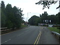
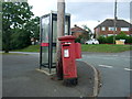
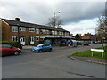
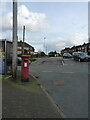
Photos of B31 4NH

Area Information
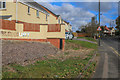
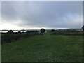
B31 4NH is a compact residential postcode in south-west Birmingham, nestled within the Longbridge & West Heath ward. Its 3,745 m² area accommodates 1,488 residents, creating a densely populated yet small-scale community. Historically a heathland and farmland, the area transformed post-World War II into a suburban dormitory for Birmingham, with housing developments from the 1940s onward. Today, it lies between Kings Norton, Northfield, and Cofton Hackett, with proximity to Worcestershire adding a regional dimension. The area’s character blends traditional architecture, such as old railway workers’ cottages, with modern amenities. Residents benefit from nearby town centres like Longbridge and Austin, as well as green spaces like Cofton Park. While it lacks major industry, its role as a commuter suburb means many residents travel to central Birmingham for work. The postcode reflects a specific locality within West Heath, a broader ward with a population of 21,654, but B31 4NH itself remains a distinct, tightly knit residential cluster.
- Area Type
- Postcode
- Area Size
- 3745 m²
- Population
- 1488
- Population Density
- 1636 people/km²
B31 4NH is primarily a home-ownership area, with 54% of residents owning their properties. The accommodation type is houses, which is typical for a suburban postcode but contrasts with larger cities where flats dominate. This suggests a mix of semi-detached and detached homes, offering more space than high-density housing. The small area size of 3,745 m² means the housing stock is limited, and buyers may need to consider nearby suburbs like Longbridge or Northfield for more options. The high population density implies that properties are likely to be in close proximity, with little green space between them. For buyers, this area suits those prioritising ownership and a traditional suburban layout, though the limited land area may restrict future development. The presence of schools like Cofton Primary and West Heath Primary also makes it appealing for families.
House Prices in B31 4NH
Showing 32 properties
| Address | Type | Beds | Baths | Last Sale Price | Last Sale Date | |
|---|---|---|---|---|---|---|
| 58 Thelbridge Road, Birmingham, B31 4NH | Semi-detached | 3 | 1 | £190,000 | May 2021 | |
| 56 Thelbridge Road, Birmingham, B31 4NH | Semi-detached | 3 | 1 | £207,500 | Oct 2018 | |
| 34 Thelbridge Road, Birmingham, B31 4NH | Terraced | - | - | £74,000 | Apr 2007 | |
| 54 Thelbridge Road, Birmingham, B31 4NH | Semi-detached | - | - | £149,950 | Mar 2007 | |
| 36 Thelbridge Road, Birmingham, B31 4NH | house | 3 | - | £149,950 | Feb 2007 | |
| 52 Thelbridge Road, Birmingham, B31 4NH | house | - | - | £166,000 | Jan 2007 | |
| 46 Thelbridge Road, Birmingham, B31 4NH | Semi-detached | - | - | £104,965 | Dec 2006 | |
| Former 32, Thelbridge Road, Birmingham, B31 4NH | undefined | - | - | - | - | |
| Former 52, Thelbridge Road, Birmingham, B31 4NH | undefined | - | - | - | - | |
| Former 26, Thelbridge Road, Birmingham, B31 4NH | undefined | - | - | - | - |
Energy Efficiency in B31 4NH
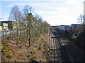
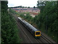
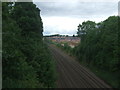
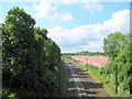
Living in B31 4NH offers access to a range of amenities within practical reach. Retail options include M&S Longbridge, Sainsburys Longbridge, and Morrisons Daily, providing everyday shopping needs. The area’s rail stations—Longbridge, Northfield, and Barnt Green—connect residents to broader networks, while nearby parks like Cofton Park and West Heath Park offer green space for leisure. Notable features include the West Heath Community Centre, historic churches such as St. Anne’s and St. John Fisher, and local schools like Cofton Primary and Albert Bradbeer School. The Man On The Moon pub and old railway workers’ cottages on Station Road add to the area’s character. While the small size limits large-scale facilities, the proximity to Longbridge town centre and the presence of a small industrial estate on Lightning Way provide a mix of convenience and local industry.
Amenities
Schools
| Rank | School | Type | Entry gender | Ages |
|---|
Explore more schools in this area
Go to Schools tabDemographics
The population of B31 4NH is 1,488, with a median age of 47, indicating a mature demographic skewed toward adults aged 30–64. Home ownership stands at 54%, suggesting a balance between owner-occupied properties and rental units. The accommodation type is predominantly houses, reflecting a low-rise, residential character rather than high-density housing. The predominant ethnic group is White, though the data does not specify proportions of other groups. The area’s population density of 397,379 people per km² is exceptionally high, implying limited space per resident. This density may influence the sense of community, with shared amenities and proximity to neighbours. However, it also means the area is fully developed, leaving little scope for expansion. The age profile suggests a stable, established community, with potential for family-oriented living, though the lack of younger demographics may affect local schools and services.
Household Size
Accommodation Type
Tenure
Ethnic Group
Religion
Household Composition
Age
Household Deprivation
NS-SEC
Explore more demographic insights in this area
Go to Demographics tabPlanning
Planning Constraints
- Flood RiskPremium
- Ramsar Wetland SitesPremium
- Area of Outstanding Natural BeautyPremium
- Protected Nature ReservePremium
- Protected WoodlandPremium