Area Overview for B31 4NG
Photos of B31 4NG
Area Information
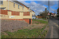
B31 4NG is a small, densely populated residential cluster in south-west Birmingham, nestled within the broader West Heath area. Covering just 1,383 square metres, it is home to 1,488 people, creating a high population density of over 1 million per square kilometre. Historically a heathland area, it transformed into a suburban dormitory post-World War II, with housing developments from the 1940s-1970s. Today, it serves as a commuter hub for central Birmingham, with residents often working in the city but living in this quiet, residential setting. The area blends practicality with local charm, featuring nearby parks, schools, and rail links. Its proximity to Longbridge railway station and proximity to Birmingham’s motorways make it accessible, while the character of the area reflects its origins as a post-war suburb. Living here means balancing suburban tranquillity with the convenience of nearby urban amenities.
- Area Type
- Postcode
- Area Size
- 1383 m²
- Population
- 1488
- Population Density
- 1636 people/km²
The property market in B31 4NG is characterised by a 54% home ownership rate, with houses forming the predominant accommodation type. This suggests a focus on family homes and long-term residency rather than a transient rental market. Given the area’s small size and high population density, the housing stock is limited, likely comprising a mix of post-war and more recent developments. The presence of houses over flats implies a quieter, more private living environment compared to high-density urban areas. For buyers, this means competition for available properties, particularly in a small area with limited expansion potential. The market may appeal to those seeking a suburban lifestyle with proximity to Birmingham’s urban core, though the small size of the postcode means buyers should consider nearby areas for broader options.
House Prices in B31 4NG
Showing 9 properties
| Address | Type | Beds | Baths | Last Sale Price | Last Sale Date | |
|---|---|---|---|---|---|---|
| 6 Lannacombe Road, Birmingham, B31 4NG | Semi-detached | - | - | - | - | |
| Former 5, Lannacombe Road, Birmingham, B31 4NG | Semi-detached | - | - | - | - | |
| Former 7, Lannacombe Road, Birmingham, B31 4NG | Semi-detached | - | - | - | - | |
| 8 Lannacombe Road, Birmingham, B31 4NG | Semi-detached | - | - | - | - | |
| 9 Lannacombe Road, Birmingham, B31 4NG | house | - | - | - | - | |
| 1 Lannacombe Road, Birmingham, B31 4NG | house | - | - | - | - | |
| 3 Lannacombe Road, Birmingham, B31 4NG | house | - | - | - | - | |
| 7 Lannacombe Road, Birmingham, B31 4NG | house | - | - | - | - | |
| 5 Lannacombe Road, Birmingham, B31 4NG | house | - | - | - | - |
Energy Efficiency in B31 4NG
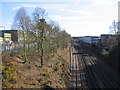
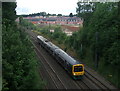
Residents of B31 4NG have access to a range of amenities within practical reach. Retail options include M&S Longbridge, Sainsburys Longbridge, and Morrisons Daily, catering to everyday needs. The area’s rail stations, such as Longbridge and Northfield, provide easy access to Birmingham’s urban centres, while the Edgbaston Village metro station adds to transport flexibility. Green spaces like West Heath Park and Cofton Park offer recreational opportunities, and local schools such as Cofton Primary, West Heath Primary, and St. John Fisher Roman Catholic Primary serve families. The area also features community hubs like the West Heath Community Centre and historic sites like Longbridge House. This mix of retail, transport, greenery, and education creates a balanced lifestyle, blending suburban comfort with urban accessibility.
Amenities
Schools
| Rank | School | Type | Entry gender | Ages |
|---|
Explore more schools in this area
Go to Schools tabDemographics
The population of B31 4NG has a median age of 47, with the majority of residents aged between 30 and 64. This suggests a community of established families and middle-aged professionals. Home ownership rates stand at 54%, indicating a stable, long-term resident base, though nearly half of households are likely renters. The area is predominantly composed of houses, reflecting a traditional suburban layout. The predominant ethnic group is White, though specific data on diversity or deprivation is not provided. With 54% of homes owned by residents, the area likely supports a sense of community through shared ownership and long-term residency. The age profile suggests a mix of families with children and older adults, which may influence local amenities and services.
Household Size
Accommodation Type
Tenure
Ethnic Group
Religion
Household Composition
Age
Household Deprivation
NS-SEC
Explore more demographic insights in this area
Go to Demographics tabPlanning
Planning Constraints
- Flood RiskPremium
- Ramsar Wetland SitesPremium
- Area of Outstanding Natural BeautyPremium
- Protected Nature ReservePremium
- Protected WoodlandPremium