Area Overview for B31 3TP
Photos of B31 3TP
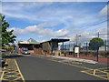


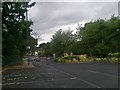
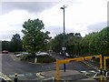
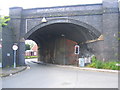
65 photos from this area
Area Information
Key information about the B31 3TP including its size, population, and administrative classification.
- Area Type
- Postcode
- Area Size
- 7522 m²
- Population
- 1818
- Population Density
- 6215 people/km²
House Prices in B31 3TP
32
Properties
£119,220
Average Sold Price
£39,950
Lowest Price
£222,500
Highest Price
Showing 32 properties
| Address | Type | Beds | Baths | Last Sale Price | Last Sale Date | |
|---|---|---|---|---|---|---|
| 26 Bowood Crescent, Birmingham, B31 3TP | Terraced | 3 | 1 | £209,000 | Dec 2025 | |
| 30 Bowood Crescent, Birmingham, B31 3TP | Terraced | 3 | - | £214,500 | Oct 2023 | |
| 8 Bowood Crescent, Birmingham, B31 3TP | Retail | 3 | 1 | £222,500 | Sep 2022 | |
| 28 Bowood Crescent, Birmingham, B31 3TP | house | 3 | - | £142,500 | Apr 2021 | |
| 14 Bowood Crescent, Birmingham, B31 3TP | Terraced | 3 | 1 | £148,000 | Dec 2019 | |
| 4 Bowood Crescent, Birmingham, B31 3TP | Terraced | 3 | 1 | £143,000 | Dec 2016 | |
| 42 Bowood Crescent, Birmingham, B31 3TP | Terraced | 3 | 1 | £121,000 | Dec 2016 | |
| 32 Bowood Crescent, Birmingham, B31 3TP | Terraced | 3 | - | £122,000 | Sep 2013 | |
| 23 Bowood Crescent, Birmingham, B31 3TP | house | - | - | £122,000 | Sep 2007 | |
| 44 Bowood Crescent, Birmingham, B31 3TP | Terraced | - | - | £124,999 | Oct 2006 |
Page 1 of 4
Energy Efficiency in B31 3TP
Amenities
Schools
| Rank | School | Type | Entry gender | Ages |
|---|
Explore more schools in this area
Go to Schools tabDemographics
Household Size
One person
most common
Accommodation Type
Houses
most common
Tenure
50
majority
Ethnic Group
White
most common
Religion
N/A
most common
Household Composition
N/A
most common
Age
47
median
Adults (30-64 years)
most common
Household Deprivation
N/A
with no deprivation
NS-SEC
27
in Lower managerial occupations
Explore more demographic insights in this area
Go to Demographics tabPlanning
Planning Constraints
- Flood RiskPremium
- Ramsar Wetland SitesPremium
- Area of Outstanding Natural BeautyPremium
- Protected Nature ReservePremium
- Protected WoodlandPremium