Area Overview for B31 3JR
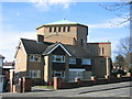
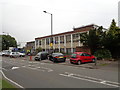
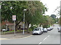
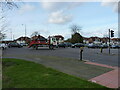
Photos of B31 3JR


Area Information
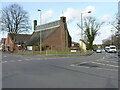
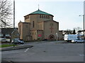
B31 3JR is a small, densely populated postcode in south-west Birmingham, England, encompassing a compact residential cluster within the broader Longbridge & West Heath area. With 1,774 residents spread across 1,020 square metres, the area has a high population density of 1,739,140 people per square kilometre, reflecting its suburban character. Historically a heathland and farmland, it transformed into a post-war housing estate to accommodate returning servicemen and bombing victims. Today, it serves as a dormitory suburb for Birmingham’s central districts, with residents commuting via nearby rail links. The area’s proximity to Kings Norton, Northfield, and Longbridge provides easy access to urban amenities while retaining a residential feel. Its compact size means community life is tightly woven, with local landmarks such as West Heath Park, St. Anne’s Church, and the historic Longbridge railway station anchoring daily life. The mix of permanent housing and proximity to Birmingham’s transport networks makes it a practical choice for those seeking a balance between suburban tranquillity and urban connectivity.
- Area Type
- Postcode
- Area Size
- 1020 m²
- Population
- 1774
- Population Density
- 5326 people/km²
B31 3JR is characterised by a housing stock that is predominantly composed of houses, with 48% of properties owned by residents. This suggests a balance between owner-occupied homes and rental properties, though the exact proportion of rentals is not specified. The area’s compact size means property availability is limited, and buyers should consider the proximity to Birmingham’s urban core as a key factor. The presence of permanent housing, as opposed to high-rise or shared accommodation, indicates a focus on family homes and long-term residency. Given the area’s role as a dormitory suburb, property values may reflect demand from commuters seeking proximity to Birmingham’s transport networks. Buyers should also note the small scale of the postcode, which may limit immediate housing options but ensures a tightly knit community with established local amenities.
House Prices in B31 3JR
Showing 3 properties
| Address | Type | Beds | Baths | Last Sale Price | Last Sale Date | |
|---|---|---|---|---|---|---|
| 1 Redhill Road, Northfield, Birmingham, B31 3JR | Semi-detached | 4 | 2 | £172,000 | Nov 2019 | |
| 3 Redhill Road, Northfield, Birmingham, B31 3JR | Semi-detached | 2 | - | £79,000 | Jul 2011 | |
| 5 Redhill Road, Northfield, Birmingham, B31 3JR | house | - | - | - | - |
Energy Efficiency in B31 3JR
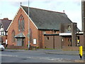
B31 3JR offers a range of amenities within practical reach, including five retail outlets such as Tesco West, Morrisons Daily, and Co-op Longbridge, ensuring daily shopping needs are met. The area’s proximity to rail stations like Northfield, Longbridge, and Kings Norton, along with metro stops at Edgbaston Village and Centenary Square, provides seamless access to Birmingham’s urban core. Local parks such as West Heath Park and Cofton Park offer green spaces for recreation, while community hubs like the West Heath Community Centre and historic sites like St. Anne’s Church contribute to a sense of place. The presence of schools like Cofton Primary and West Heath Primary caters to families, and nearby industrial areas like the Lightning Way estate hint at a mix of residential and light commercial activity. This blend of suburban comfort and urban connectivity ensures a lifestyle that balances convenience with a distinct local character.
Amenities
Schools
| Rank | School | Type | Entry gender | Ages |
|---|
Explore more schools in this area
Go to Schools tabDemographics
The population of B31 3JR has a median age of 47, with the majority of residents aged between 30 and 64. This suggests a community skewed towards middle-aged adults, likely including families and professionals. Home ownership rates stand at 48%, indicating a mix of owner-occupied properties and rental units. The area is predominantly composed of houses, which aligns with the typical housing stock of suburban Birmingham. The predominant ethnic group is White, though no specific data on diversity or deprivation is provided. The age profile implies a stable, established community with a focus on long-term residency. The absence of detailed diversity statistics means broader demographic trends remain unexplored, but the age range and home ownership figures suggest a mature, settled population. For those considering relocation, the area’s demographics reflect a practical, family-oriented environment with limited turnover.
Household Size
Accommodation Type
Tenure
Ethnic Group
Religion
Household Composition
Age
Household Deprivation
NS-SEC
Explore more demographic insights in this area
Go to Demographics tabPlanning
Planning Constraints
- Flood RiskPremium
- Ramsar Wetland SitesPremium
- Area of Outstanding Natural BeautyPremium
- Protected Nature ReservePremium
- Protected WoodlandPremium