Area Overview for B31 3HT
Photos of B31 3HT

Area Information
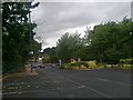
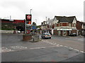
Living in B31 3HT means being part of a small, densely populated residential cluster in south-west Birmingham, England. This postcode covers 7,214 m² and is home to 1,648 residents, making it one of the most densely populated areas in the UK at 228,430 people per square kilometre. The area lies on the boundary with Worcestershire, nestled between Kings Norton, Northfield, and Longbridge. Historically a heathland, it transformed into a suburban dormitory post-World War II, with housing developments from the 1940s-1970s. Today, it serves as a commuter hub for central Birmingham, with residents often working in nearby urban centres. The area’s character blends modest residential streets with pockets of green space, such as West Heath Park. Its proximity to rail networks and retail hubs like Tesco West and Morrisons Daily adds to its practical appeal. While the community is tight-knit, the high density means living here requires a balance between urban convenience and the challenges of limited space.
- Area Type
- Postcode
- Area Size
- 7214 m²
- Population
- 1648
- Population Density
- 4056 people/km²
The property market in B31 3HT is defined by a 36% home ownership rate, indicating that most residents rent their homes. The accommodation type is predominantly houses, which are typically larger and suited to families. This suggests a housing stock that caters to settled, long-term residents rather than short-term renters. Given the area’s small size and high density, the number of available properties is likely limited, making it a competitive market for buyers. The prevalence of houses may also mean that newer developments or flats are scarce, limiting options for those seeking different property types. For buyers, this means focusing on existing homes rather than speculative investment, with potential challenges in finding properties that meet specific needs. The area’s role as a commuter suburb further aligns with its housing profile, as properties are designed for convenience rather than luxury.
House Prices in B31 3HT
Showing 19 properties
| Address | Type | Beds | Baths | Last Sale Price | Last Sale Date | |
|---|---|---|---|---|---|---|
| 36 Pitclose Road, Birmingham, B31 3HT | Semi-detached | 2 | 1 | £225,000 | Oct 2024 | |
| 28 Pitclose Road, Birmingham, B31 3HT | Semi-detached | 2 | 1 | £217,000 | Oct 2024 | |
| 26 Pitclose Road, Birmingham, B31 3HT | Semi-detached | 2 | 1 | £129,600 | May 2020 | |
| 12 Pitclose Road, Birmingham, B31 3HT | Semi-detached | 2 | 1 | £143,000 | Jan 2020 | |
| 2 Pitclose Road, Birmingham, B31 3HT | Semi-detached | 3 | 1 | £175,000 | May 2019 | |
| 34 Pitclose Road, Birmingham, B31 3HT | Semi-detached | 2 | - | £130,000 | Apr 2018 | |
| 22 Pitclose Road, Birmingham, B31 3HT | Semi-detached | - | - | £41,600 | Jan 2005 | |
| 18 Pitclose Road, Birmingham, B31 3HT | Semi-detached | - | - | £36,000 | May 1998 | |
| 4 Pitclose Road, Birmingham, B31 3HT | Semi-detached | 2 | 1 | - | - | |
| 30 Pitclose Road, Birmingham, B31 3HT | house | - | - | - | - |
Energy Efficiency in B31 3HT
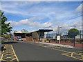
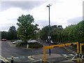
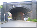
Residents of B31 3HT have access to a range of amenities within practical reach, including retail outlets like Tesco West, Co-op Longbridge, and Morrisons Daily, which cater to everyday shopping needs. The area’s proximity to rail stations and metro hubs such as Edgbaston Village and Centenary Square connects it to Birmingham’s cultural and commercial centres. Parks like West Heath Park and Cofton Park offer green spaces for recreation, while historic sites such as St. Anne’s Church and the Man On The Moon pub add character. The presence of community facilities like the West Heath Community Centre and schools underscores a focus on local engagement. Despite its density, the area retains pockets of suburban charm, with historic features like old railway workers’ cottages. This blend of practicality and heritage creates a lifestyle that balances convenience with a sense of place, though the limited size of the postcode means some amenities may require travel to nearby wards.
Amenities
Schools
Residents of B31 3HT have access to three primary schools: West Heath Infant School, West Heath Junior School, and West Heath Primary School, which holds an Ofsted rating of ‘good’. These institutions cater to younger children, providing a range of educational options within the area. The presence of three primary schools suggests a focus on early education, though no secondary schools are listed in the data. For families, this means proximity to primary education is strong, but further schooling may require travel to nearby areas. The ‘good’ rating at West Heath Primary indicates a reliable standard of teaching, which is crucial for parents prioritising quality education. The clustering of schools also implies a community-oriented approach to education, with local facilities serving multiple households. However, the absence of secondary schools highlights a potential gap for older students.
| Rank | School | Type | Entry gender | Ages |
|---|
Explore more schools in this area
Go to Schools tabDemographics
The population of B31 3HT is predominantly adults aged 30-64, with a median age of 47. This suggests a mature, stable community with a focus on family living, reflected in the 36% home ownership rate. The area is characterised by houses rather than flats, indicating a preference for standalone properties. The predominant ethnic group is White, though specific data on diversity is not provided. The high population density of 228,430 people per km² implies a compact, possibly multi-generational living environment. With 36% of homes owned by residents, the remaining 64% are likely rented, pointing to a rental market that may influence property availability. The absence of detailed deprivation data means the quality of life is inferred from amenities and safety assessments. This demographic profile suggests a community prioritising stability over transient lifestyles, with a focus on established housing rather than new developments.
Household Size
Accommodation Type
Tenure
Ethnic Group
Religion
Household Composition
Age
Household Deprivation
NS-SEC
Explore more demographic insights in this area
Go to Demographics tabPlanning
Planning Constraints
- Flood RiskPremium
- Ramsar Wetland SitesPremium
- Area of Outstanding Natural BeautyPremium
- Protected Nature ReservePremium
- Protected WoodlandPremium