Area Overview for B31 3HP
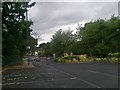
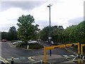
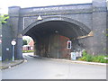
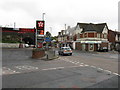
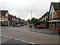
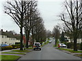
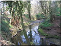
Photos of B31 3HP


Area Information
B31 3HP is a compact residential postcode nestled in south-west Birmingham, straddling the boundary with Worcestershire. With a population of 1,648 spread across 7,464 square metres, it is one of the city’s most densely populated areas. Historically a village centred on Lilley Lane, it evolved into a post-war suburb with prefabricated housing that later gave way to permanent estates. Today, it functions as a dormitory area for central Birmingham commuters, with a quiet, residential character. The area’s proximity to Kings Norton, Northfield, and Longbridge offers easy access to urban amenities while retaining a village-like atmosphere. Residents benefit from nearby schools, retail hubs, and transport links, making it a practical choice for families and professionals. The high population density reflects its role as a compact, well-served suburb, though its small size means community interactions are frequent and localised. Its history as part of Kings Norton manorial lands adds a layer of historical continuity to its modern suburban identity.
- Area Type
- Postcode
- Area Size
- 7464 m²
- Population
- 1648
- Population Density
- 4056 people/km²
The property market in B31 3HP is characterised by a 36% home ownership rate, indicating that the majority of properties are rented rather than owner-occupied. The accommodation type is predominantly houses, reflecting the area’s suburban layout and historical development as a residential suburb. This mix of housing stock suggests a focus on family homes, though the small size of the postcode means the available properties are limited in number. For buyers, the area’s compact nature means competition for available homes may be intense, particularly for those seeking owner-occupied properties. The presence of rental properties also implies a steady demand from tenants, which could influence property values and availability. Given the area’s proximity to Birmingham’s urban core, it may appeal to those seeking a quieter residential environment with easy access to city amenities.
House Prices in B31 3HP
Showing 20 properties
| Address | Type | Beds | Baths | Last Sale Price | Last Sale Date | |
|---|---|---|---|---|---|---|
| 6 Tristram Avenue, Birmingham, B31 3HP | Semi-detached | 2 | 1 | £180,000 | Nov 2025 | |
| 21 Tristram Avenue, Birmingham, B31 3HP | Semi-detached | 2 | - | £158,000 | Sep 2025 | |
| 23 Tristram Avenue, Birmingham, B31 3HP | Semi-detached | 3 | 1 | £190,000 | Nov 2024 | |
| 7 Tristram Avenue, Birmingham, B31 3HP | Semi-detached | 2 | 1 | £145,000 | Feb 2023 | |
| 22 Tristram Avenue, Birmingham, B31 3HP | Terraced | 3 | 1 | £170,000 | Mar 2022 | |
| 16 Tristram Avenue, Birmingham, B31 3HP | house | - | - | £120,000 | May 2018 | |
| 15 Tristram Avenue, Birmingham, B31 3HP | Semi-detached | 2 | 1 | £99,000 | Feb 2015 | |
| 11 Tristram Avenue, Birmingham, B31 3HP | Semi-detached | 2 | 1 | £75,000 | Dec 2011 | |
| 18 Tristram Avenue, Birmingham, B31 3HP | house | - | - | £130,000 | Oct 2005 | |
| 14 Tristram Avenue, Birmingham, B31 3HP | Semi-detached | - | - | £84,950 | Dec 2003 |
Energy Efficiency in B31 3HP
The lifestyle in B31 3HP is shaped by its proximity to retail, green spaces, and community hubs. Nearby amenities include supermarkets such as Tesco West, Co-op Longbridge, and Morrisons Daily, offering convenience for daily shopping. Parks like West Heath Park and Cofton Park provide recreational spaces, while community centres and pubs such as The Man On The Moon add to the area’s social fabric. The presence of St. Anne’s Church and St. John Fisher Church reflects the area’s religious diversity. For leisure, the small industrial estate on Lightning Way hints at limited commercial activity, but the focus remains on residential comfort. The mix of retail, greenery, and local venues creates a balanced lifestyle, ideal for those seeking proximity to urban amenities without the density of central Birmingham.
Amenities
Schools
Residents of B31 3HP have access to three primary schools: West Heath Infant School, West Heath Junior School, and West Heath Primary School, which holds an Ofsted rating of ‘good’. These institutions cater to younger children, providing a range of educational options within the area. The concentration of primary schools suggests a family-friendly environment, though no secondary schools are listed in the data, meaning students may need to travel to nearby areas for further education. The presence of multiple primary schools also indicates a commitment to local education, which is a key consideration for families prioritising proximity to schools. The ‘good’ rating at West Heath Primary School adds a layer of reassurance for parents seeking quality early education for their children.
| Rank | School | Type | Entry gender | Ages |
|---|
Explore more schools in this area
Go to Schools tabDemographics
The population of B31 3HP is predominantly adults aged 30–64, with a median age of 47. This suggests a community of established professionals and families, though the 36% home ownership rate indicates a significant proportion of residents are renting. The area is largely composed of houses, reflecting a mix of older properties and post-war developments. The predominant ethnic group is White, with no specific data on other demographics. The high population density of 220,784 people per square kilometre underscores the area’s compact nature, which may contribute to a sense of community but also limited space for expansion. For quality of life, the mix of age groups and housing types suggests a balance between stability and affordability, though the low home ownership rate may indicate a transient population or reliance on rental markets.
Household Size
Accommodation Type
Tenure
Ethnic Group
Religion
Household Composition
Age
Household Deprivation
NS-SEC
Explore more demographic insights in this area
Go to Demographics tabPlanning
Planning Constraints
- Flood RiskPremium
- Ramsar Wetland SitesPremium
- Area of Outstanding Natural BeautyPremium
- Protected Nature ReservePremium
- Protected WoodlandPremium