Area Overview for B31 3HA
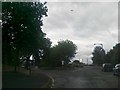
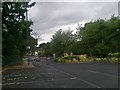
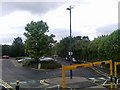
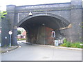
Photos of B31 3HA


Area Information
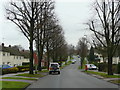
Living in B31 3HA means inhabiting a small, densely populated residential cluster in south-west Birmingham. The area covers just 1.1 hectares, with 1,818 residents packed at a density of 172,450 people per square kilometre. This postcode sits on the boundary with Worcestershire, historically part of Kings Norton manorial lands, and is now a suburban ward within the Longbridge & West Heath electoral division. The area has evolved from 19th-century heathland into a post-war housing estate, with many homes built in the 1940s-1970s to accommodate returning servicemen and displaced families. Today, it serves as a dormitory suburb for central Birmingham commuters, with limited local industry beyond a small industrial estate on Lightning Way. Its proximity to Kings Norton, Northfield, and Longbridge offers easy access to urban amenities, while its compact size means residents often look beyond the immediate postcode for larger retail or leisure options.
- Area Type
- Postcode
- Area Size
- 1.1 hectares
- Population
- 1818
- Population Density
- 6215 people/km²
B31 3HA’s property market is defined by its compact size and 50% home ownership rate, suggesting a balance between owner-occupied and rental properties. The area is predominantly composed of houses, which may reflect a mix of family homes and smaller residences suited to the local demographic. Given the postcode’s small footprint, the housing stock is limited, meaning buyers may need to consider nearby areas for more options. The presence of houses rather than flats indicates a focus on traditional, single-family living, which could appeal to those prioritising space and privacy. However, the small size of the area means property availability is constrained, and buyers should be prepared to look beyond B31 3HA for larger selections.
House Prices in B31 3HA
Showing 26 properties
| Address | Type | Beds | Baths | Last Sale Price | Last Sale Date | |
|---|---|---|---|---|---|---|
| 19 The Morelands, Birmingham, B31 3HA | house | - | - | £236,000 | Apr 2025 | |
| 12 The Morelands, Birmingham, B31 3HA | Semi-detached | 3 | - | £250,000 | Oct 2023 | |
| 10 The Morelands, Birmingham, B31 3HA | Semi-detached | 3 | 1 | £217,500 | Feb 2023 | |
| 8 The Morelands, Birmingham, B31 3HA | Semi-detached | 3 | 1 | £325,000 | Dec 2020 | |
| 20 The Morelands, Birmingham, B31 3HA | Semi-detached | 3 | 1 | £235,000 | Mar 2019 | |
| 15 The Morelands, Birmingham, B31 3HA | Semi-detached | 3 | - | £210,000 | Feb 2016 | |
| 23 The Morelands, Birmingham, B31 3HA | house | - | - | £150,000 | Jul 2011 | |
| 29 The Morelands, Birmingham, B31 3HA | house | 3 | - | £108,000 | Nov 2010 | |
| 27 The Morelands, Birmingham, B31 3HA | Semi-detached | - | - | £80,000 | Sep 2001 | |
| 11 The Morelands, Birmingham, B31 3HA | Terraced | - | - | £62,000 | Aug 1997 |
Energy Efficiency in B31 3HA
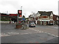
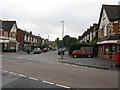
Residents of B31 3HA have access to a range of amenities within walking or short driving distance. Five retail outlets, including Tesco West, Co-op Longbridge, and Morrisons Daily, provide everyday shopping needs. The area’s proximity to railway stations and metro stops ensures easy access to Birmingham’s broader urban network. Nearby parks such as West Heath Park and Cofton Park offer green spaces for recreation, while community centres like West Heath Community Centre provide social and cultural activities. The presence of pubs like The Man On The Moon and historical sites like Longbridge House adds character to the area. While the immediate postcode has limited amenities, its location near larger suburbs means residents can enjoy a mix of suburban tranquillity and urban convenience.
Amenities
Schools
The only school explicitly listed near B31 3HA is West Heath Nursery School, which provides early education for young children. No primary or secondary schools are named in the data, though nearby areas such as Cofton Park and West Heath are known to host schools like Cofton Primary and St. John Fisher Roman Catholic Primary. Families requiring a broader range of educational options may need to look beyond the immediate postcode. The absence of specific school ratings or Ofsted data means prospective buyers should investigate local institutions independently. For those prioritising nursery care, West Heath Nursery School offers a practical starting point, but secondary education options may require commuting to adjacent wards.
| Rank | School | Type | Entry gender | Ages |
|---|
Explore more schools in this area
Go to Schools tabDemographics
The population of B31 3HA is 1,818, with a median age of 47 and the majority of residents falling into the 30-64 age range. This suggests a community of middle-aged adults, likely including families and professionals. Home ownership sits at 50%, with houses the predominant accommodation type, indicating a mix of owner-occupied and rental properties. The predominant ethnic group is White, though specific data on diversity or deprivation is absent. The age profile suggests a stable, long-term resident base, with fewer young families or retirees compared to areas with younger demographics. The high population density, combined with the age range, points to a community that balances domestic life with commuting to Birmingham’s central districts.
Household Size
Accommodation Type
Tenure
Ethnic Group
Religion
Household Composition
Age
Household Deprivation
NS-SEC
Explore more demographic insights in this area
Go to Demographics tabPlanning
Planning Constraints
- Flood RiskPremium
- Ramsar Wetland SitesPremium
- Area of Outstanding Natural BeautyPremium
- Protected Nature ReservePremium
- Protected WoodlandPremium