Area Overview for B31 3EZ
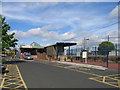
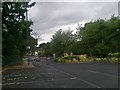
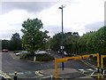
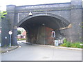
Photos of B31 3EZ


Area Information
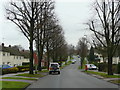
B31 3EZ is a compact residential postcode in south-west Birmingham, England, nestled within the Longbridge & West Heath area. With a population of 1,818 spread across 1,526 square metres, the area is densely populated, reflecting its role as a suburban dormitory for Birmingham. Historically a heathland, it transformed post-World War II into a housing estate to accommodate returning servicemen and families displaced by war. Today, it is a quiet residential cluster with a median age of 47, dominated by adults aged 30–64. The area’s proximity to Kings Norton, Northfield, and Longbridge offers easy access to urban amenities while retaining a distinct suburban character. Its small size and high population density mean it is a tightly knit community, though its limited scope requires buyers to consider nearby areas for broader services. The postcode’s location on the boundary with Worcestershire adds a touch of regional diversity to its identity.
- Area Type
- Postcode
- Area Size
- 1526 m²
- Population
- 1818
- Population Density
- 6215 people/km²
B31 3EZ is a small area where 50% of homes are owner-occupied, with houses forming the majority of the accommodation stock. This suggests a mix of long-term residents and buyers seeking stable, family-friendly housing. The limited size of the postcode means the property market is constrained, with fewer options than larger urban areas. The presence of houses rather than flats indicates a focus on traditional suburban living, which may appeal to those prioritising space and privacy. However, the high population density and small area size could mean limited availability for buyers, requiring consideration of nearby postcodes for broader choices. The 50% home ownership rate also implies a rental market segment, though its scale is not specified.
House Prices in B31 3EZ
Showing 3 properties
| Address | Type | Beds | Baths | Last Sale Price | Last Sale Date | |
|---|---|---|---|---|---|---|
| 154 West Heath Road, Northfield, Birmingham, B31 3EZ | Detached | - | - | £173,000 | Feb 2007 | |
| 152 West Heath Road, Northfield, Birmingham, B31 3EZ | Semi-detached | 4 | 2 | - | - | |
| 150 West Heath Road, Northfield, Birmingham, B31 3EZ | Semi-detached | - | - | - | - |
Energy Efficiency in B31 3EZ
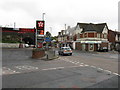
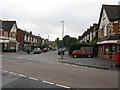
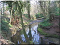
B31 3EZ offers a blend of suburban tranquillity and urban accessibility. Nearby retail options include Tesco West, Co-op Longbridge, and Morrisons Daily, providing essential shopping. Parks such as West Heath Park and Cofton Park offer green spaces for recreation, while community hubs like the West Heath Community Centre provide local engagement. The area’s historical roots in heathland and post-war housing create a distinct character, with remnants like old railway workers’ cottages adding charm. Dining and leisure options are sparse within the postcode, but nearby towns like Longbridge and Kings Norton offer more choices. The mix of retail, green spaces, and transport links supports a lifestyle balancing convenience with a sense of community, though residents may need to travel further for broader amenities.
Amenities
Schools
The only school explicitly listed near B31 3EZ is West Heath Nursery School, which provides early education services. No primary or secondary schools are named in the data, meaning families with older children may need to look beyond the immediate area for schooling options. The presence of a nursery school suggests the area caters to younger families, but the lack of higher-tier educational institutions could be a consideration for those prioritising local schools. Nearby schools such as Cofton Primary and West Heath Primary, mentioned in the area’s research, are not formally included in the postcode’s amenities. This highlights the importance of verifying school locations beyond the immediate postcode boundary.
| Rank | School | Type | Entry gender | Ages |
|---|
Explore more schools in this area
Go to Schools tabDemographics
The population of B31 3EZ is 1,818, with a median age of 47, indicating a mature community. The most common age group is adults aged 30–64, suggesting a stable demographic profile. Home ownership stands at 50%, with houses being the predominant accommodation type. This contrasts with areas where rental markets dominate, implying a balance between owner-occupied and rented properties. The predominant ethnic group is White, though no specific data on diversity or deprivation levels is provided. The high population density of 1,191,385 people per square kilometre reflects the area’s compact nature, which may influence living conditions and community dynamics. For families, the age profile suggests a mix of working professionals and retirees, with limited data on younger demographics or student populations.
Household Size
Accommodation Type
Tenure
Ethnic Group
Religion
Household Composition
Age
Household Deprivation
NS-SEC
Explore more demographic insights in this area
Go to Demographics tabPlanning
Planning Constraints
- Flood RiskPremium
- Ramsar Wetland SitesPremium
- Area of Outstanding Natural BeautyPremium
- Protected Nature ReservePremium
- Protected WoodlandPremium