Area Overview for B31 3DH
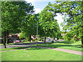
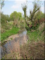
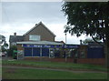
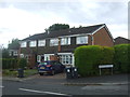
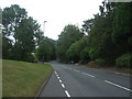
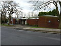
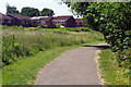
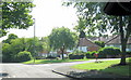
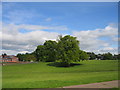
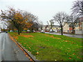
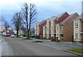
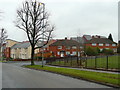
Photos of B31 3DH
Area Information
Living in B31 3DH means being part of a tightly knit residential cluster in Birmingham’s southern suburbs. The area covers 3,268 square metres and is home to 2,073 residents, making it one of the city’s more densely populated postcode areas. Historically part of Worcestershire, it now falls under Birmingham City Council. Its compact size means daily life is shaped by proximity to local amenities, schools, and transport links. The area’s character is rooted in its past as a trading hub for wool and pottery, with the Worcester and Birmingham Canal still running through nearby streets. While modern infrastructure is evident, the community retains a sense of tradition, with a median age of 47 and a population skewed toward adults aged 30–64. This demographic suggests a stable, family-oriented environment, though the 23% home ownership rate indicates a rental-heavy market. For buyers, B31 3DH offers a mix of convenience and compact living, but its small size means competition for properties.
- Area Type
- Postcode
- Area Size
- 3268 m²
- Population
- 2073
- Population Density
- 7317 people/km²
The property market in B31 3DH is characterised by a low home ownership rate of 23%, indicating that the majority of residents rent their homes. This suggests a rental market rather than a strong buyer’s market, which could be due to the area’s small size and limited housing stock. The accommodation type is primarily houses, though the exact proportion of flats or other property types is not specified. For buyers, this means competition for properties is likely, particularly given the area’s compact nature. The focus on houses may appeal to families seeking more space, but the high population density implies that private outdoor space is scarce. Prospective buyers should consider the area’s proximity to transport links and amenities, which may offset the lack of available properties. However, the rental-heavy market could also mean that properties are more likely to be available for purchase if owners decide to move.
House Prices in B31 3DH
Showing 10 properties
| Address | Type | Beds | Baths | Last Sale Price | Last Sale Date | |
|---|---|---|---|---|---|---|
| 4 Ombersley Way, Birmingham, B31 3DH | Semi-detached | - | - | - | - | |
| 11 Ombersley Way, Birmingham, B31 3DH | Bungalow | - | - | - | - | |
| 12 Ombersley Way, Birmingham, B31 3DH | Bungalow | - | - | - | - | |
| 8 Ombersley Way, Birmingham, B31 3DH | house | - | - | - | - | |
| 6 Ombersley Way, Birmingham, B31 3DH | Semi-detached | - | - | - | - | |
| 7 Ombersley Way, Birmingham, B31 3DH | house | - | - | - | - | |
| 3 Ombersley Way, Birmingham, B31 3DH | Detached | 3 | 3 | - | - | |
| 9 Ombersley Way, Birmingham, B31 3DH | Semi-detached | - | - | - | - | |
| 10 Ombersley Way, Birmingham, B31 3DH | Bungalow | - | - | - | - | |
| 5 Ombersley Way, Birmingham, B31 3DH | house | - | - | - | - |
Energy Efficiency in B31 3DH
Residents of B31 3DH have access to a range of amenities within practical reach, including retail outlets like Spar, Aldi Tunnel, and Co-op Longbridge. These shops provide everyday essentials, supporting a convenient lifestyle. The area’s proximity to rail and metro stations, such as Kings Norton and Bournville, ensures easy access to Birmingham’s cultural and commercial hubs. The Worcester and Birmingham Canal, a historic feature, adds character and offers recreational opportunities. While the data does not mention parks or leisure facilities explicitly, the canal’s presence suggests opportunities for walking or cycling. The combination of retail, transport, and historical infrastructure creates a balanced lifestyle, blending modern convenience with traditional charm.
Amenities
Schools
Residents of B31 3DH have access to several primary schools, including Wychall Farm Junior School, Wychall Farm Infant School, St Thomas Aquinas Catholic School, and Wychall Primary School. Among these, St Thomas Aquinas Catholic School is an academy with an Ofsted rating of “good,” offering a notable option for families. The presence of multiple primary schools suggests a strong focus on early education, though no secondary schools are listed in the data. The variety of school types allows parents to choose between traditional state schools and faith-based institutions. However, the absence of secondary schools may require families to commute for secondary education. The high quality of at least one school, combined with the area’s density, could make B31 3DH attractive for families prioritising primary education but may necessitate planning for longer-term schooling needs.
| Rank | School | Type | Entry gender | Ages |
|---|
Explore more schools in this area
Go to Schools tabDemographics
The community in B31 3DH is predominantly composed of adults aged 30–64, with a median age of 47. This suggests a mature population, likely with established careers and families. Home ownership is low at 23%, meaning most residents rent their homes, which could indicate a transient population or limited availability of owner-occupied properties. The area is largely composed of houses, though the exact distribution of household types is not specified. The predominant ethnic group is White, and while no data on diversity is provided, this aligns with broader trends in Birmingham’s suburban areas. The high population density of 634,245 people per square kilometre—despite the area’s small size—implies a tightly packed community. This density may influence the availability of private outdoor space, with many residents relying on shared or public green areas. The age profile and ownership rates suggest a community focused on stability, though the rental market may offer flexibility for those seeking short-term housing.
Household Size
Accommodation Type
Tenure
Ethnic Group
Religion
Household Composition
Age
Household Deprivation
NS-SEC
Explore more demographic insights in this area
Go to Demographics tabPlanning
Planning Constraints
- Flood RiskPremium
- Ramsar Wetland SitesPremium
- Area of Outstanding Natural BeautyPremium
- Protected Nature ReservePremium
- Protected WoodlandPremium