Area Overview for B30 3NT
Photos of B30 3NT
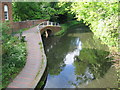
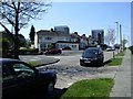
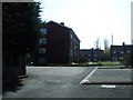
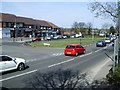

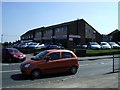
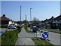
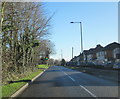
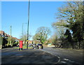

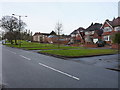
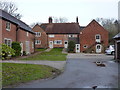
54 photos from this area
Area Information
Key information about the B30 3NT including its size, population, and administrative classification.
- Area Type
- Postcode
- Area Size
- 8215 m²
- Population
- 2795
- Population Density
- 4257 people/km²
House Prices in B30 3NT
39
Properties
£257,697
Average Sold Price
£169,995
Lowest Price
£360,000
Highest Price
Showing 39 properties
| Address | Type | Beds | Baths | Last Sale Price | Last Sale Date | |
|---|---|---|---|---|---|---|
| 45 Navigation Drive, Birmingham, B30 3NT | house | 4 | - | £360,000 | Jun 2021 | |
| 26 Navigation Drive, Birmingham, B30 3NT | Detached | 4 | - | £333,500 | Dec 2019 | |
| 53 Navigation Drive, Birmingham, B30 3NT | Terraced | 3 | - | £175,000 | Mar 2017 | |
| 28 Navigation Drive, Birmingham, B30 3NT | Detached | 4 | 1 | £284,000 | Jun 2016 | |
| 31 Navigation Drive, Birmingham, B30 3NT | Detached | - | - | £291,000 | Nov 2007 | |
| 43 Navigation Drive, Birmingham, B30 3NT | house | 4 | - | £230,000 | Oct 2006 | |
| 51 Navigation Drive, Birmingham, B30 3NT | Terraced | - | - | £194,000 | Jul 2006 | |
| 41 Navigation Drive, Birmingham, B30 3NT | Detached | - | - | £274,995 | Jun 2006 | |
| 47 Navigation Drive, Birmingham, B30 3NT | Detached | 4 | - | £290,000 | May 2006 | |
| 49 Navigation Drive, Birmingham, B30 3NT | Terraced | - | - | £266,580 | Apr 2006 |
Page 1 of 4
Energy Efficiency in B30 3NT
Amenities
Schools
| Rank | School | Type | Entry gender | Ages |
|---|
Explore more schools in this area
Go to Schools tabDemographics
Household Size
Family (3-5 people)
most common
Accommodation Type
Houses
most common
Tenure
71
majority
Ethnic Group
White
most common
Religion
N/A
most common
Household Composition
N/A
most common
Age
47
median
Adults (30-64 years)
most common
Household Deprivation
N/A
with no deprivation
NS-SEC
37
in Lower managerial occupations
Explore more demographic insights in this area
Go to Demographics tabPlanning
Planning Constraints
- Flood RiskPremium
- Ramsar Wetland SitesPremium
- Area of Outstanding Natural BeautyPremium
- Protected Nature ReservePremium
- Protected WoodlandPremium