Area Overview for B30 3NE
Photos of B30 3NE
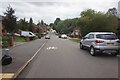
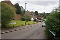
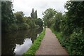
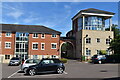
40 photos from this area
Area Information
Key information about the B30 3NE including its size, population, and administrative classification.
- Area Type
- Postcode
- Area Size
- 2.2 hectares
- Population
- 2795
- Population Density
- 4257 people/km²
House Prices in B30 3NE
57
Properties
£252,750
Average Sold Price
£42,500
Lowest Price
£520,000
Highest Price
Showing 57 properties
| Address | Type | Beds | Baths | Last Sale Price | Last Sale Date | |
|---|---|---|---|---|---|---|
| 61 Trostrey Road, Birmingham, B30 3NE | house | 5 | 3 | £520,000 | Mar 2024 | |
| 14 Trostrey Road, Birmingham, B30 3NE | house | - | - | £357,000 | May 2023 | |
| 1 Trostrey Road, Birmingham, B30 3NE | Detached | 5 | 3 | £392,500 | Jul 2022 | |
| 10 Trostrey Road, Birmingham, B30 3NE | Detached | 5 | - | £420,000 | Dec 2021 | |
| 27 Trostrey Road, Birmingham, B30 3NE | house | - | - | £255,000 | Dec 2021 | |
| 56 Trostrey Road, Birmingham, B30 3NE | house | - | - | £270,000 | Apr 2021 | |
| 29 Trostrey Road, Birmingham, B30 3NE | Terraced | 3 | 2 | £230,000 | Apr 2021 | |
| 60 Trostrey Road, Birmingham, B30 3NE | Terraced | 2 | 1 | £150,000 | Oct 2020 | |
| 51 Trostrey Road, Birmingham, B30 3NE | Semi-detached | 3 | - | £265,000 | Jul 2019 | |
| 3 Trostrey Road, Birmingham, B30 3NE | Detached | 4 | 2 | £333,000 | Apr 2019 |
Page 1 of 6
Energy Efficiency in B30 3NE
Amenities
Schools
| Rank | School | Type | Entry gender | Ages |
|---|
Explore more schools in this area
Go to Schools tabDemographics
Household Size
Family (3-5 people)
most common
Accommodation Type
Houses
most common
Tenure
71
majority
Ethnic Group
White
most common
Religion
N/A
most common
Household Composition
N/A
most common
Age
47
median
Adults (30-64 years)
most common
Household Deprivation
N/A
with no deprivation
NS-SEC
37
in Lower managerial occupations
Explore more demographic insights in this area
Go to Demographics tabPlanning
Planning Constraints
- Flood RiskPremium
- Ramsar Wetland SitesPremium
- Area of Outstanding Natural BeautyPremium
- Protected Nature ReservePremium
- Protected WoodlandPremium