Area Overview for B30 3DR
Photos of B30 3DR
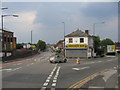
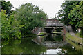
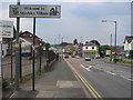
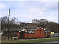

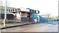
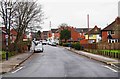
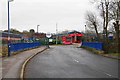
100 photos from this area
Area Information
Key information about the B30 3DR including its size, population, and administrative classification.
- Area Type
- Postcode
- Area Size
- 3.1 hectares
- Population
- 1675
- Population Density
- 3493 people/km²
House Prices in B30 3DR
12
Properties
£54,250
Average Sold Price
£40,000
Lowest Price
£84,000
Highest Price
Showing 12 properties
| Address | Type | Beds | Baths | Last Sale Price | Last Sale Date | |
|---|---|---|---|---|---|---|
| 1655 Pershore Road, Bournville, Birmingham, B30 3DR | house | - | - | £84,000 | Jan 2003 | |
| 1657A Pershore Road, Bournville, Birmingham, B30 3DR | Flat | - | - | £50,000 | Sep 2002 | |
| 1659 Pershore Road, Bournville, Birmingham, B30 3DR | Industrial | - | - | £43,000 | Apr 1999 | |
| 1653 Pershore Road, Bournville, Birmingham, B30 3DR | house | - | - | £40,000 | Nov 1995 | |
| First Floor Flat, 1657 Pershore Road, Bournville, Birmingham, B30 3DR | Flat | - | - | - | - | |
| Ground Floor Flat, 1657 Pershore Road, Bournville, Birmingham, B30 3DR | Flat | - | - | - | - | |
| 1657 Pershore Road, Bournville, Birmingham, B30 3DR | Flat | - | - | - | - | |
| 1667 Pershore Road, Bournville, Birmingham, B30 3DR | commercial | - | - | - | - | |
| Savoy Works, Pershore Road, Bournville, Birmingham, B30 3DR | retail_financial | - | - | - | - | |
| Unit 5, Waterside Business Park, Pershore Road, Bournville, Birmingham, B30 3DR | Industrial | - | - | - | - |
Page 1 of 2
Energy Efficiency in B30 3DR
Amenities
Schools
| Rank | School | Type | Entry gender | Ages |
|---|
Explore more schools in this area
Go to Schools tabDemographics
Household Size
Two person
most common
Accommodation Type
Houses
most common
Tenure
63
majority
Ethnic Group
White
most common
Religion
N/A
most common
Household Composition
N/A
most common
Age
47
median
Adults (30-64 years)
most common
Household Deprivation
N/A
with no deprivation
NS-SEC
45
in Lower managerial occupations
Explore more demographic insights in this area
Go to Demographics tabPlanning
Planning Constraints
- Flood RiskPremium
- Ramsar Wetland SitesPremium
- Area of Outstanding Natural BeautyPremium
- Protected Nature ReservePremium
- Protected WoodlandPremium