Area Overview for B29 7RB
Photos of B29 7RB
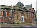
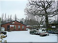
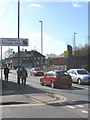
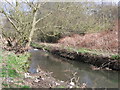

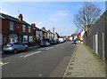
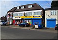
100 photos from this area
Area Information
Key information about the B29 7RB including its size, population, and administrative classification.
- Area Type
- Postcode
- Area Size
- 6441 m²
- Population
- 1546
- Population Density
- 7118 people/km²
House Prices in B29 7RB
23
Properties
£154,020
Average Sold Price
£45,000
Lowest Price
£290,000
Highest Price
Showing 23 properties
| Address | Type | Beds | Baths | Last Sale Price | Last Sale Date | |
|---|---|---|---|---|---|---|
| 16 Warwards Lane, Birmingham, B29 7RB | Terraced | 2 | 1 | £217,500 | Sep 2025 | |
| 26 Warwards Lane, Birmingham, B29 7RB | Semi-detached | 2 | - | £153,000 | Apr 2024 | |
| 20 Warwards Lane, Birmingham, B29 7RB | Terraced | 2 | 1 | £145,000 | Jun 2023 | |
| 36 Warwards Lane, Birmingham, B29 7RB | Terraced | 3 | 2 | £248,500 | Mar 2023 | |
| 26A Warwards Lane, Birmingham, B29 7RB | house | - | - | £188,500 | Nov 2020 | |
| 42 Warwards Lane, Birmingham, B29 7RB | Terraced | 6 | 2 | £290,000 | Jan 2020 | |
| 12 Warwards Lane, Birmingham, B29 7RB | Terraced | 2 | 1 | £155,500 | Dec 2018 | |
| 44 Warwards Lane, Birmingham, B29 7RB | Terraced | 4 | 1 | £175,000 | Feb 2017 | |
| 2, Garden Cottages, Warwards Lane, Birmingham, B29 7RB | house | - | - | £147,000 | Jul 2016 | |
| 18 Warwards Lane, Birmingham, B29 7RB | Terraced | 2 | 1 | £119,950 | Apr 2016 |
Page 1 of 3
Energy Efficiency in B29 7RB
Amenities
Schools
| Rank | School | Type | Entry gender | Ages |
|---|
Explore more schools in this area
Go to Schools tabDemographics
Household Size
Family (3-5 people)
most common
Accommodation Type
Houses
most common
Tenure
58
majority
Ethnic Group
White
most common
Religion
N/A
most common
Household Composition
N/A
most common
Age
47
median
Adults (30-64 years)
most common
Household Deprivation
N/A
with no deprivation
NS-SEC
31
in Lower managerial occupations
Explore more demographic insights in this area
Go to Demographics tabPlanning
Planning Constraints
- Flood RiskPremium
- Ramsar Wetland SitesPremium
- Area of Outstanding Natural BeautyPremium
- Protected Nature ReservePremium
- Protected WoodlandPremium