Area Overview for B29 6EX
Photos of B29 6EX
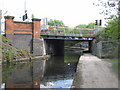

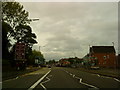
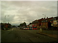
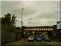

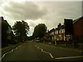
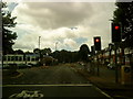
100 photos from this area
Area Information
Key information about the B29 6EX including its size, population, and administrative classification.
- Area Type
- Postcode
- Area Size
- 4020 m²
- Population
- 2523
- Population Density
- 17743 people/km²
House Prices in B29 6EX
37
Properties
£207,656
Average Sold Price
£60,000
Lowest Price
£520,000
Highest Price
Showing 37 properties
| Address | Type | Beds | Baths | Last Sale Price | Last Sale Date | |
|---|---|---|---|---|---|---|
| 76 Exeter Road, Birmingham, B29 6EX | house | - | - | £520,000 | Aug 2022 | |
| 90 Exeter Road, Birmingham, B29 6EX | Retail | 2 | 1 | £280,000 | Jun 2021 | |
| 43 Exeter Road, Birmingham, B29 6EX | house | - | - | £285,000 | Aug 2017 | |
| 92 Exeter Road, Birmingham, B29 6EX | Terraced | 6 | 6 | £265,000 | Mar 2016 | |
| 84 Exeter Road, Birmingham, B29 6EX | Terraced | 4 | 3 | £386,000 | Feb 2016 | |
| 68 Exeter Road, Birmingham, B29 6EX | Terraced | 7 | 7 | £245,000 | Dec 2015 | |
| 86 Exeter Road, Birmingham, B29 6EX | house | 6 | 3 | £147,000 | Nov 2011 | |
| 80 Exeter Road, Birmingham, B29 6EX | house | 5 | 3 | £161,500 | Nov 2011 | |
| 53 Exeter Road, Birmingham, B29 6EX | Detached | 7 | 3 | £190,000 | Feb 2008 | |
| 78 Exeter Road, Birmingham, B29 6EX | house | 7 | 2 | £163,000 | Jan 2008 |
Page 1 of 4
Energy Efficiency in B29 6EX
Amenities
Schools
| Rank | School | Type | Entry gender | Ages |
|---|
Explore more schools in this area
Go to Schools tabDemographics
Household Size
Family (3-5 people)
most common
Accommodation Type
Houses
most common
Tenure
11
majority
Ethnic Group
White
most common
Religion
N/A
most common
Household Composition
N/A
most common
Age
22
median
Young Adults (15-29 years)
most common
Household Deprivation
N/A
with no deprivation
NS-SEC
4
in Lower managerial occupations
Explore more demographic insights in this area
Go to Demographics tabPlanning
Planning Constraints
- Flood RiskPremium
- Ramsar Wetland SitesPremium
- Area of Outstanding Natural BeautyPremium
- Protected Nature ReservePremium
- Protected WoodlandPremium