Area Overview for B28 0DU
Photos of B28 0DU
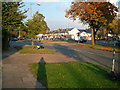

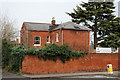
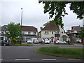
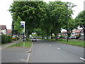
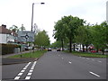
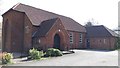
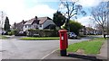
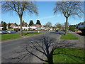
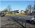
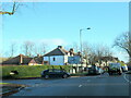
21 photos from this area
Area Information
Key information about the B28 0DU including its size, population, and administrative classification.
- Area Type
- Postcode
- Area Size
- 1.0 hectares
- Population
- 1909
- Population Density
- 3869 people/km²
House Prices in B28 0DU
12
Properties
£380,250
Average Sold Price
£197,000
Lowest Price
£510,000
Highest Price
Showing 12 properties
| Address | Type | Beds | Baths | Last Sale Price | Last Sale Date | |
|---|---|---|---|---|---|---|
| 62 Paradise Lane, Birmingham, B28 0DU | Bungalow | 5 | 3 | £510,000 | Jul 2025 | |
| 44 Paradise Lane, Birmingham, B28 0DU | Bungalow | 3 | 3 | £490,000 | Jul 2023 | |
| 38 Paradise Lane, Birmingham, B28 0DU | Detached | 3 | 2 | £420,000 | Mar 2023 | |
| 54 Paradise Lane, Birmingham, B28 0DU | Bungalow | - | - | £390,000 | Feb 2022 | |
| 46 Paradise Lane, Birmingham, B28 0DU | Bungalow | - | - | £345,000 | Sep 2021 | |
| 42 Paradise Lane, Birmingham, B28 0DU | house | - | - | £360,000 | Jul 2021 | |
| 50 Paradise Lane, Birmingham, B28 0DU | Bungalow | 2 | 1 | £330,000 | Dec 2020 | |
| 60 Paradise Lane, Birmingham, B28 0DU | Terraced | - | - | £197,000 | Jul 2004 | |
| 40 Paradise Lane, Birmingham, B28 0DU | Detached | 4 | - | - | - | |
| 56 Paradise Lane, Birmingham, B28 0DU | Terraced | - | - | - | - |
Page 1 of 2
Energy Efficiency in B28 0DU
Amenities
Schools
| Rank | School | Type | Entry gender | Ages |
|---|
Explore more schools in this area
Go to Schools tabDemographics
Household Size
One person
most common
Accommodation Type
Houses
most common
Tenure
71
majority
Ethnic Group
White
most common
Religion
N/A
most common
Household Composition
N/A
most common
Age
47
median
Adults (30-64 years)
most common
Household Deprivation
N/A
with no deprivation
NS-SEC
35
in Lower managerial occupations
Explore more demographic insights in this area
Go to Demographics tabPlanning
Planning Constraints
- Flood RiskPremium
- Ramsar Wetland SitesPremium
- Area of Outstanding Natural BeautyPremium
- Protected Nature ReservePremium
- Protected WoodlandPremium