Area Overview for B28 0DS
Photos of B28 0DS
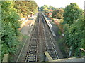
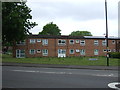
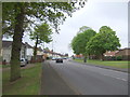
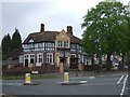
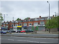
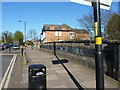
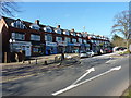
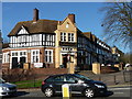
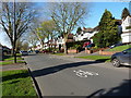
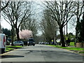
35 photos from this area
Area Information
Key information about the B28 0DS including its size, population, and administrative classification.
- Area Type
- Postcode
- Area Size
- 1.2 hectares
- Population
- 1909
- Population Density
- 3869 people/km²
House Prices in B28 0DS
13
Properties
£311,227
Average Sold Price
£101,000
Lowest Price
£695,000
Highest Price
Showing 13 properties
| Address | Type | Beds | Baths | Last Sale Price | Last Sale Date | |
|---|---|---|---|---|---|---|
| 16 Paradise Lane, Birmingham, B28 0DS | house | - | - | £695,000 | Nov 2022 | |
| 26 Paradise Lane, Birmingham, B28 0DS | house | - | - | £376,000 | Mar 2021 | |
| 28 Paradise Lane, Birmingham, B28 0DS | Semi-detached | 4 | 2 | £435,000 | Aug 2019 | |
| 8 Paradise Lane, Birmingham, B28 0DS | house | - | - | £287,500 | Jun 2015 | |
| 6 Paradise Lane, Birmingham, B28 0DS | house | - | - | £232,000 | Nov 2012 | |
| 20 Paradise Lane, Birmingham, B28 0DS | Detached | - | - | £249,999 | Oct 2009 | |
| 4 Paradise Lane, Birmingham, B28 0DS | Detached | - | - | £350,000 | Oct 2007 | |
| 22 Paradise Lane, Birmingham, B28 0DS | Semi-detached | - | - | £270,000 | Oct 2005 | |
| 14 Paradise Lane, Birmingham, B28 0DS | Semi-detached | - | - | £215,000 | Jan 2005 | |
| 12 Paradise Lane, Birmingham, B28 0DS | Detached | - | - | £212,000 | Nov 2003 |
Page 1 of 2
Energy Efficiency in B28 0DS
Amenities
Schools
| Rank | School | Type | Entry gender | Ages |
|---|
Explore more schools in this area
Go to Schools tabDemographics
Household Size
One person
most common
Accommodation Type
Houses
most common
Tenure
71
majority
Ethnic Group
White
most common
Religion
N/A
most common
Household Composition
N/A
most common
Age
47
median
Adults (30-64 years)
most common
Household Deprivation
N/A
with no deprivation
NS-SEC
35
in Lower managerial occupations
Explore more demographic insights in this area
Go to Demographics tabPlanning
Planning Constraints
- Flood RiskPremium
- Ramsar Wetland SitesPremium
- Area of Outstanding Natural BeautyPremium
- Protected Nature ReservePremium
- Protected WoodlandPremium