Area Overview for B28 0DG
Photos of B28 0DG
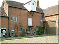
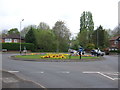
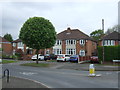
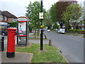
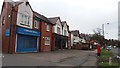
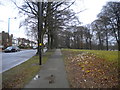
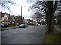
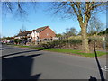
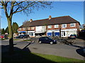
79 photos from this area
Area Information
Key information about the B28 0DG including its size, population, and administrative classification.
- Area Type
- Postcode
- Area Size
- 2.0 hectares
- Population
- 1909
- Population Density
- 3869 people/km²
House Prices in B28 0DG
28
Properties
£178,286
Average Sold Price
£58,000
Lowest Price
£274,000
Highest Price
Showing 28 properties
| Address | Type | Beds | Baths | Last Sale Price | Last Sale Date | |
|---|---|---|---|---|---|---|
| 151 Cole Valley Road, Birmingham, B28 0DG | house | - | - | £195,000 | Jun 2021 | |
| 155 Cole Valley Road, Birmingham, B28 0DG | Semi-detached | 3 | 1 | £255,000 | Jan 2020 | |
| 163 Cole Valley Road, Birmingham, B28 0DG | Semi-detached | 3 | 1 | £250,000 | Feb 2019 | |
| 137 Cole Valley Road, Birmingham, B28 0DG | house | - | - | £250,000 | Apr 2017 | |
| 133 Cole Valley Road, Birmingham, B28 0DG | Semi-detached | 5 | - | £274,000 | Sep 2015 | |
| 169 Cole Valley Road, Birmingham, B28 0DG | Detached | 4 | - | £245,000 | Nov 2013 | |
| 131 Cole Valley Road, Birmingham, B28 0DG | Bungalow | 5 | - | £163,500 | Jul 2004 | |
| 125 Cole Valley Road, Birmingham, B28 0DG | house | - | - | £162,000 | May 2004 | |
| 143 Cole Valley Road, Birmingham, B28 0DG | house | 3 | 1 | £152,500 | Dec 2003 | |
| 159 Cole Valley Road, Birmingham, B28 0DG | Detached | 4 | 1 | £220,000 | Sep 2002 |
Page 1 of 3
Energy Efficiency in B28 0DG
Amenities
Schools
| Rank | School | Type | Entry gender | Ages |
|---|
Explore more schools in this area
Go to Schools tabDemographics
Household Size
One person
most common
Accommodation Type
Houses
most common
Tenure
71
majority
Ethnic Group
White
most common
Religion
N/A
most common
Household Composition
N/A
most common
Age
47
median
Adults (30-64 years)
most common
Household Deprivation
N/A
with no deprivation
NS-SEC
35
in Lower managerial occupations
Explore more demographic insights in this area
Go to Demographics tabPlanning
Planning Constraints
- Flood RiskPremium
- Ramsar Wetland SitesPremium
- Area of Outstanding Natural BeautyPremium
- Protected Nature ReservePremium
- Protected WoodlandPremium