Area Overview for B28 0BU
Photos of B28 0BU
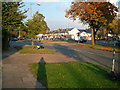

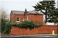
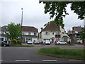
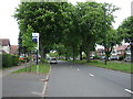
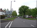
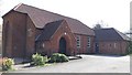
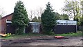
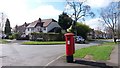
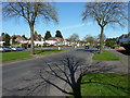
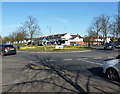
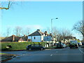
21 photos from this area
Area Information
Key information about the B28 0BU including its size, population, and administrative classification.
- Area Type
- Postcode
- Area Size
- 1.4 hectares
- Population
- 1909
- Population Density
- 3869 people/km²
House Prices in B28 0BU
16
Properties
£252,627
Average Sold Price
£104,500
Lowest Price
£417,000
Highest Price
Showing 16 properties
| Address | Type | Beds | Baths | Last Sale Price | Last Sale Date | |
|---|---|---|---|---|---|---|
| 271 Highfield Road, Hall Green, Birmingham, B28 0BU | Semi-detached | 4 | 1 | £417,000 | Apr 2024 | |
| 269 Highfield Road, Hall Green, Birmingham, B28 0BU | Semi-detached | 4 | 1 | £359,950 | Mar 2019 | |
| 261 Highfield Road, Hall Green, Birmingham, B28 0BU | Semi-detached | 3 | 1 | £325,000 | Dec 2017 | |
| 267 Highfield Road, Hall Green, Birmingham, B28 0BU | Semi-detached | 4 | 1 | £360,000 | Jun 2017 | |
| 285 Highfield Road, Hall Green, Birmingham, B28 0BU | Flat | - | - | £117,500 | Mar 2017 | |
| 283 Highfield Road, Hall Green, Birmingham, B28 0BU | Flat | - | - | £146,000 | Nov 2013 | |
| 265 Highfield Road, Hall Green, Birmingham, B28 0BU | Detached | - | - | £244,000 | May 2008 | |
| 273 Highfield Road, Hall Green, Birmingham, B28 0BU | Semi-detached | - | - | £319,950 | Nov 2007 | |
| 275 Highfield Road, Hall Green, Birmingham, B28 0BU | Land | - | - | £250,000 | May 2006 | |
| 277 Highfield Road, Hall Green, Birmingham, B28 0BU | Detached | - | - | £135,000 | Nov 1996 |
Page 1 of 2
Energy Efficiency in B28 0BU
Amenities
Schools
| Rank | School | Type | Entry gender | Ages |
|---|
Explore more schools in this area
Go to Schools tabDemographics
Household Size
One person
most common
Accommodation Type
Houses
most common
Tenure
71
majority
Ethnic Group
White
most common
Religion
N/A
most common
Household Composition
N/A
most common
Age
47
median
Adults (30-64 years)
most common
Household Deprivation
N/A
with no deprivation
NS-SEC
35
in Lower managerial occupations
Explore more demographic insights in this area
Go to Demographics tabPlanning
Planning Constraints
- Flood RiskPremium
- Ramsar Wetland SitesPremium
- Area of Outstanding Natural BeautyPremium
- Protected Nature ReservePremium
- Protected WoodlandPremium