Area Overview for B27 7TS
Photos of B27 7TS
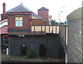
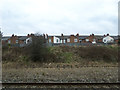
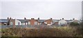
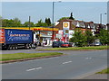
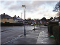
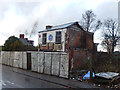
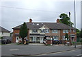
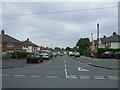
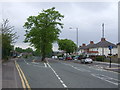
52 photos from this area
Area Information
Key information about the B27 7TS including its size, population, and administrative classification.
- Area Type
- Postcode
- Area Size
- 1.8 hectares
- Population
- 1867
- Population Density
- 9634 people/km²
House Prices in B27 7TS
51
Properties
£125,071
Average Sold Price
£59,950
Lowest Price
£197,000
Highest Price
Showing 51 properties
| Address | Type | Beds | Baths | Last Sale Price | Last Sale Date | |
|---|---|---|---|---|---|---|
| 92 Ninfield Road, Birmingham, B27 7TS | Flat | 1 | 1 | £106,500 | Mar 2025 | |
| 46 Ninfield Road, Birmingham, B27 7TS | Terraced | 3 | 1 | £197,000 | Oct 2020 | |
| 50 Ninfield Road, Birmingham, B27 7TS | Semi-detached | 3 | 1 | £155,000 | Aug 2020 | |
| 10 Ninfield Road, Birmingham, B27 7TS | Terraced | 3 | 1 | £181,500 | Dec 2018 | |
| 28 Ninfield Road, Birmingham, B27 7TS | house | 3 | 1 | £192,000 | Nov 2018 | |
| 64 Ninfield Road, Birmingham, B27 7TS | house | - | - | £166,500 | Sep 2018 | |
| 30 Ninfield Road, Birmingham, B27 7TS | house | 3 | 1 | £150,500 | Apr 2015 | |
| 32 Ninfield Road, Birmingham, B27 7TS | house | - | - | £116,000 | Jan 2015 | |
| 44 Ninfield Road, Birmingham, B27 7TS | house | 3 | - | £135,500 | Aug 2014 | |
| 48 Ninfield Road, Birmingham, B27 7TS | Terraced | 4 | 2 | £143,003 | Aug 2013 |
Page 1 of 6
Energy Efficiency in B27 7TS
Amenities
Schools
| Rank | School | Type | Entry gender | Ages |
|---|
Explore more schools in this area
Go to Schools tabDemographics
Household Size
Family (3-5 people)
most common
Accommodation Type
Houses
most common
Tenure
51
majority
Ethnic Group
asian_total
most common
Religion
N/A
most common
Household Composition
N/A
most common
Age
47
median
Adults (30-64 years)
most common
Household Deprivation
N/A
with no deprivation
NS-SEC
13
in Lower managerial occupations
Explore more demographic insights in this area
Go to Demographics tabPlanning
Planning Constraints
- Flood RiskPremium
- Ramsar Wetland SitesPremium
- Area of Outstanding Natural BeautyPremium
- Protected Nature ReservePremium
- Protected WoodlandPremium